
Lakeland Provincial Recreation Area Adventure Topographic Map
Lakeland Provincial Recreation Area Map Alberta
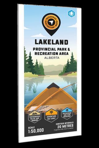
Highlighting the Lakeland Provincial Park and Recreation Area near Lac La Biche, Alberta, this map features the ATV and snowmobile trails, canoe route and its access point, campsites, portage trails with distance markers, fish species, hiking trails and recreation features in the area. Use for ATVing, fishing, camping, exploring, canoeing, kayaking, hiking, skiing, snowmobiling, wildlife viewing and more. No other map for the area provides you with this level of recreational or topographic detail. Covering the entire canoe route and surrounding area, this 1:50,000 scale map includes Lakeland Provincial Park, Lakeland Provincial Recreation Area, Blackett Lake, Elinor Lake, Helena Lake, Ironwood Lake, Jackson Lake, Kinnaird Lake, Pinehurst Lake, Seibert Lake, Shaw Lake, Spencer Lake, Touchwood Lake and more.
The printed version of the map is displayed at 1:50,000 scale on 61 x 94 cm (24 x 37 in) paperon a durable waterproof synthe
- Product Number: BRM_ADV_LAKELAND_23
- Reference Product Number: - None -
- ISBN: - None -
- Date of Publication: 12/1/2023
- Folded Size: 9 inches high by 4 inches wide
- Unfolded (flat) Size: 37 inches high by 24 inches wide
- Map format: Folded
- Map type: Trade Maps - Outdoor Recreation Maps
- Geographical region: Canada
- Geographical subregion: Alberta


