
Kootenay National Park Adventure Topographic Map
Kootenay National Park Map BC
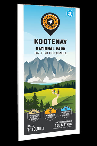
Providing a detailed overview of Kootenay National Park in BC, this recreation map highlights all the main roads and trails, campsites, hot springs and notable recreation areas, backroad attractions, larger lakes and river systems, paddling routes and more! Shown at 1:120,000 scale, this map features topographic relief shading and is the perfect planning tool for exploring this breathtaking park. Included on this map are Kootenay Crossing, Radium Hot Springs, Vermillion Crossing, Brisco Range, East Kootenay Fire Road, Great Divide Trail, Hawk Creek, Hector Gorge, Highway 93, Kindersley Creek, Kootenay River, Marble Canyon, Mount Sinclair, Numa Pass, Ochre Creek, Redstreak Campsite, Simpson River, Stanley Glacier, Vermillion River and more!
The printed version of the map is displayed at 1:120,000 scale on 61 x 94 cm (24 x 37 in) paper. You can choose between having the map printed on regular water-resistant paper or a more durable waterproof sy
- Product Number: BRM_ADV_KOOT_NP_23
- Reference Product Number: - None -
- ISBN: - None -
- Date of Publication: 9/1/2023
- Folded Size: 9 inches high by 4 inches wide
- Unfolded (flat) Size: 37 inches high by 24 inches wide
- Map format: Folded
- Map type: Trade Maps - Outdoor Recreation Maps
- Geographical region: Canada
- Geographical subregion: British Columbia


