
Kakwa Provincial Parks Adventure Topographic Map
Kakwa Provincial Parks - Alberta & BC Park Map
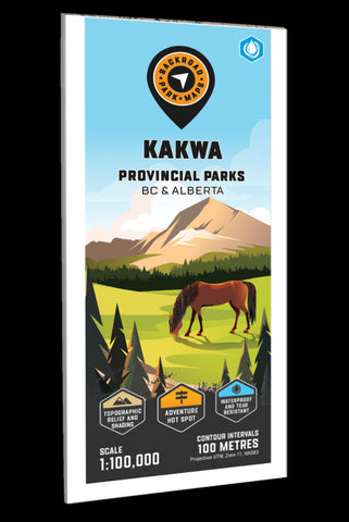
Covering Kakwa Wildland Provincial Park in Alberta and Kakwa Provincial Park and Protected Area in BC, this topographic recreation map shows you all the access roads, trails for hiking, mountain biking, horseback riding, snowshoeing, cross-country skiing, ATVing and snowmobiling, backcountry huts and cabins, fishing lakes and rivers, waterfalls, viewpoints, recreation sites, campgrounds, backcountry campsites and more! Using 1:10,000 & 1:20,000 scale data, this map features our industry-leading topographic contours and relief shading, giving you more detail than any other map for this area. Included on the map are Kakwa Falls, Kakwa Lake, Broadview Lake, Cecilia Lake, Corniche Pass, Deadhorse Meadows, Francis Peak, Jarvis Lakes, McGregor River, Moonias Pass, Mount Ian Monroe, Mount Ruth, Narraway River, Sulfur Ridge, Torrens River, Trench Creek, Two Lakes, Walker Creek Forest Service Road and more!
The printed version of the map
- Product Number: BRM_ADV_KAKWA_23
- Reference Product Number: - None -
- ISBN: - None -
- Date of Publication: 12/1/2023
- Folded Size: 9 inches high by 4 inches wide
- Unfolded (flat) Size: 37 inches high by 24 inches wide
- Map format: Folded
- Map type: Trade Maps - Outdoor Recreation Maps
- Geographical region: Canada
- Geographical subregion: Alberta,British Columbia


