
Hamber Provincial Park Adventure Topographic Map
Hamber Provincial Park Map BC
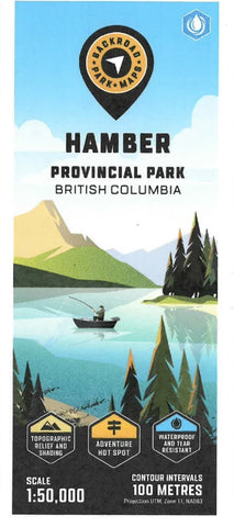
Covering Hamber Provincial Park in BC, this recreation topographic map highlights all the hiking trails, backcountry campsites, fishing lakes and rivers, waterfalls, resorts and more! Using 1:10,000 scale data, this map features our industry-leading topographic contours and relief shading and is the most detailed map available for this remote wilderness park. Included on the map are Fortress Lake, Alnus Creek, Chaba River, Chisel Creek, Chisel Peak, East End Campsite, Fortress Creek Campsite, Fortress Lake Retreat, Ghost Mountain, Lick Peak, Mount Sadleir, Serenity Mountain, Washout Creek Campsite, Wood River, Younghusband Ridge and more!
The printed version of the map is displayed at 1:50,000 scale on 61 x 94 cm (24 x 37 in) paper on a durable waterproof synthetic material. The Wall Maps have been customized to display nicely and fit into common picture frame sizes so you can hang on the cabin, home or workshop wall. They are available in three
- Product Number: BRM_ADV_HAMBER_23
- Reference Product Number: - None -
- ISBN: - None -
- Date of Publication: 12/1/2023
- Folded Size: 9 inches high by 4 inches wide
- Unfolded (flat) Size: 37 inches high by 24 inches wide
- Map format: Folded
- Map type: Trade Maps - Outdoor Recreation Maps
- Geographical region: Canada
- Geographical subregion: British Columbia


