
Berg Lake – Mount Robson Provincial Park Adventure Topographic Map
Berg Lake - Mount Robson Provincial Park Map BC
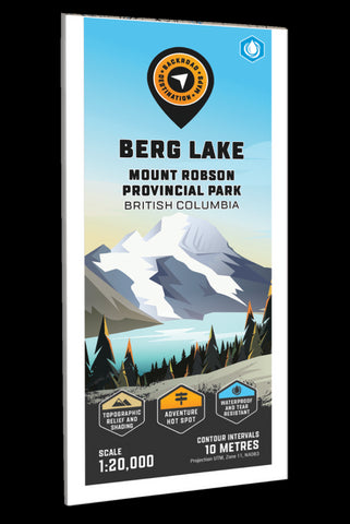
Focusing on the Berg Lake area of Mount Robson Provincial Park, this BRMB Adventure topographic map shows you all the nearby access roads, trails for hiking, cross-country skiing and mountain biking, campgrounds, backcountry campsites and shelters, fishing lakes and rivers, viewpoints, waterfalls and more! This Adventure map features our industry leading topographic contours and relief shading and includes the areas of Berg Lake, Campion Mountain, Cinnamon Peak, Emperor Falls, Fraser River, Hargreaves Lake, Kinney Lake, Mount Robson, Overlander Falls, Rearguard Mountain, Robson River, the Park Visitor Centre and more!
Note: Due to extreme flooding of the Robson River that resulted in severe trail damage, the Berg Lake Trail is CLOSED for the 2022 season as of April 1, 2022.
The printed version of the map is displayed at 1:20,000 scale on 61 x 94 cm (24 x 37 in) paper on a durable waterproof synthetic material. The Wall Maps h
- Product Number: BRM_ADV_BERG_23
- Reference Product Number: - None -
- ISBN: - None -
- Date of Publication: 12/1/2023
- Folded Size: 9 inches high by 4 inches wide
- Unfolded (flat) Size: 37 inches high by 24 inches wide
- Map format: Folded
- Map type: Trade Maps - Outdoor Recreation Maps
- Geographical region: Canada
- Geographical subregion: British Columbia


