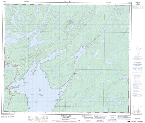
063J13 Herb Lake Canada topo map, 1:50,000 scale
063J13 Herb Lake NRCAN topographic map.
Includes UTM and GPS geographic coordinates (latitude and longitude). This 50k scale map is suitable for hiking, camping, and exploring, or you could frame it as a wall map.
Printed on-demand using high resolution, on heavy weight and acid free paper, or as an upgrade on a variety of synthetic materials.
Topos available on paper, Waterproof, Poly, or Tyvek. Usually shipping rolled, unless combined with other folded maps in one order.
- Product Number: NRCAN-063J13
- Parent Topo: TOPO-063J
- Map ID also known as: 063J13, 63J13
- Unfolded Size: Approximately 26" high by 36" wide
- Weight (paper map): ca. 55 grams
- Map Type: POD NRCAN Topographic Map
- Map Scale: 1:50,000
- Geographical region: Manitoba, Canada
Neighboring Maps:
All neighboring Canadian topo maps are available for sale online at 1:50,000 scale.
Purchase the smaller scale map covering this area: Topo-063J
Spatial coverage:
Topo map sheet 063J13 Herb Lake covers the following places:
- Anderson Bay - Angus Bay - Barton Bay - Berry Bay - Crowduck Bay - English Bay - Herb Bay - Lesleys Bay - Northeast Bay - Puella Bay - Snow Bay - Southeast Bay - Southwest Bay - Stiles Bay - Stuart Bay - Taylor Bay - Vikers Bay - Wood Camp Bay - Brady Point - Hackett Point - Wedge Point - The Narrows - Wekusko Falls - Ballard Island - Bryenton Island - Campbell Island - Crowduck Islands - Dog Island - Donogh Island - English Island - Eureka Island - Hayes Island - Lucky Island - Rice Island - Shingle Beach Island - Steamboat Island - Woosey Island - Anderson Lake - Atkins Lake - Bart Lake - Bazzlo Lake - Bob Lake - Calmain Lake - Chickadee Lake - Dion Lake - Griggs Lake - Hackett Lake - Hat Lake - Herblet Lake - Jean Lake - Johnson Lake - Judge Lake - Kormans Lake - Lost Frog Lake - Lostfrog Lake - Mary Lake - McCafferty Lake - Miller Lake - Morgan Lake - Morris Lake - Niblock Lake - Osborne Lake - Paterson Lake - Percy Lake - Pot Hole Lake - Rex Lakes - Roberts Lake - Rose Lake - Sails Lake - Senyk Lake - Snow Lake - Stall Lake - Stuart Lake - Tramping Lake - Vlassie Lake - Wekusko Lake - Wolverton Lake - Yukon Lake - Yunsko Lake - Bartlett Landing - Kerr Liftover - Wekusko Falls Provincial Park - Anderson Creek - Berry Creek - Carrier Creek - Dion Creek - Grass River - McCafferty Creek - Niblock Creek - Osborne Lake Creek - Rex Creek - Snow Creek - Stuart Creek - Wekusko Brook - Wolverton Creek - Wuskatasko Brook - Wuskatasko River - Herb Lake - McCafferty Landing - Osborne Lake - Stall Lake - Threehouse

