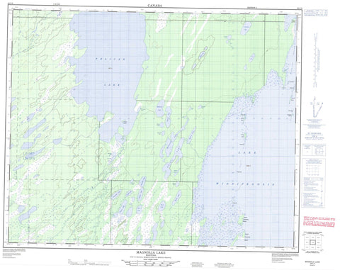
063C08 Magnolia Lake Canada topo map, 1:50,000 scale
063C08 Magnolia Lake NRCAN topographic map.
Includes UTM and GPS geographic coordinates (latitude and longitude). This 50k scale map is suitable for hiking, camping, and exploring, or you could frame it as a wall map.
Printed on-demand using high resolution, on heavy weight and acid free paper, or as an upgrade on a variety of synthetic materials.
Topos available on paper, Waterproof, Poly, or Tyvek. Usually shipping rolled, unless combined with other folded maps in one order.
- Product Number: NRCAN-063C08
- Parent Topo: TOPO-063C
- Map ID also known as: 063C08, 63C8, 63C08
- Unfolded Size: Approximately 26" high by 36" wide
- Weight (paper map): ca. 55 grams
- Map Type: POD NRCAN Topographic Map
- Map Scale: 1:50,000
- Geographical region: Manitoba, Canada
Neighboring Maps:
All neighboring Canadian topo maps are available for sale online at 1:50,000 scale.
Purchase the smaller scale map covering this area: Topo-063C
Spatial coverage:
Topo map sheet 063C08 Magnolia Lake covers the following places:
- Big Bay - Dog Point Bay - Nealeys Bay - Staple Island Bay - Base Line Point - Chartrands Point - Dog Point - Little Graveyard Point - Moose Drive Point - Nealeys Point - West Poplar Point - Blue Heron Island - Camping Islands - Cygnus Island - Dog Island - Dunoya Island - Gull Island - Half Moon Island - Nealey Island - Nealeys Islands - North Camping Island - North Camping Island Rock Pile - Pelican Island - Sand Island - Sealey Island - South Camping Island - West Camping Island - Albion Lake - Brocom Lake - Broken Stove Lake - Constance Lake - Coulter Lake - Coulter Lakes - Deitch Lake - Delaronde Lake - Emerald Lake - Erskine Lake - Ghetic Lake - Hamel Lake - Hamilton Lake - Heslop Lake - Holditch Lake - Hughes Lake - Lac Winnipegosis - Lake Winnipegosis - Magnolia Lake - Melrose Lake - Minerva Lake - Moffat Lake - Moore Lake - Morton Lake - Neldin Lake - Never Freeze Lake - Nomad Lake - North Neldin Lake - Nott Lake - Orb Lake - Orb Lakes - Pelican Lake - Prospect Lake - Rubber Lake - Snider Lake - South Neldin Lake - Tecumseh Lake - Tuxedo Lake - Vansickle Lake - West Neldin Lake - Swan-Pelican Provincial Forest - Swan-Pelican Wildlife Refuge - Big Line Creek - Never Freeze Creek - Papoose Channel - Pelican River

