
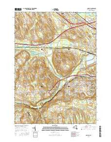
~ Camillus NY topo map, 1:24000 scale, 7.5 X 7.5 Minute, 2016
Camillus, New York, USGS topographic map dated 2016.
Includes geographic coordinates (latitude and longitude). This topographic map is suitable for hiking, camping, and exploring, or framing it as a wall map.
Printed on-demand using high resolution imagery, on heavy weight and acid free paper, or alternatively on a variety of synthetic materials.
Topos available on paper, Waterproof, Poly, or Tyvek. Usually shipping rolled, unless combined with other folded maps in one order.
- Product Number: USGS-8303115
- Free digital map download (high-resolution, GeoPDF): Camillus, New York (file size: 26 MB)
- Map Size: please refer to the dimensions of the GeoPDF map above
- Weight (paper map): ca. 55 grams
- Map Type: POD USGS Topographic Map
- Map Series: US Topo
- Map Verison: Current
- Cell ID: 6899
- Datum: North American Datum of 1983
- Map Projection: Transverse Mercator
- Map Cell Name: Camillus
- Grid size: 7.5 X 7.5 Minute
- Date on map: 2016
- Map Scale: 1:24000
- Geographical region: New York, United States
Neighboring Maps:
All neighboring USGS topo maps are available for sale online at a variety of scales.
Spatial coverage:
Topo map Camillus, New York, covers the geographical area associated the following places:
- Westerlea - Stiles - Marcellus Falls - Lindbergh Lawns - Lakeside - Camillus - Kellys Corners - Martisco - Van Buren - Sherwood Knolls - Garden Terrace - Warners - Parson Farms - Sweets Crossing - Seneca Knolls - Howlett Hill - Orchard Village - Oswego Bitter - Newport - Windcrest Park - West Genesee Terrace - Amboy - North Belle Isle - Edgewood Garden - Westview Manor - Stanley Manor - Bennetts Corners
- Map Area ID: AREA43.12543-76.375-76.25
- Northwest corner Lat/Long code: USGSNW43.125-76.375
- Northeast corner Lat/Long code: USGSNE43.125-76.25
- Southwest corner Lat/Long code: USGSSW43-76.375
- Southeast corner Lat/Long code: USGSSE43-76.25
- Northern map edge Latitude: 43.125
- Southern map edge Latitude: 43
- Western map edge Longitude: -76.375
- Eastern map edge Longitude: -76.25


