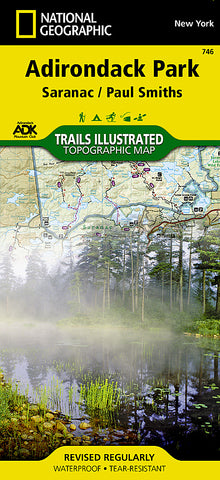
Adirondack Park, Paul Smiths and Saranac, Map 746 by National Geographic Maps
• Waterproof • Tear-Resistant • Topographic Map
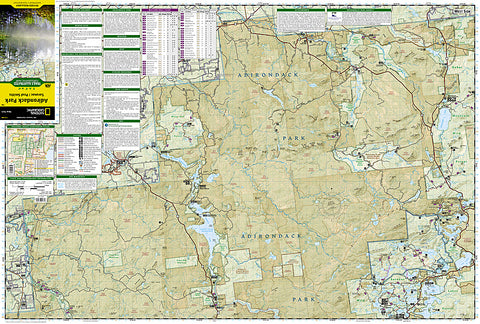
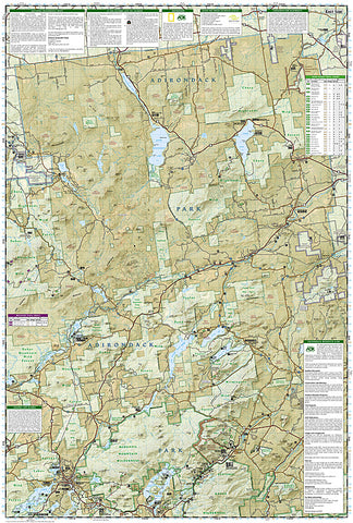
National Geographics Trails Illustrated map of Adirondack Park Saranac/Paul Smiths is a two-sided, waterproof, topographic trail map designed to meet the needs of outdoor enthusiasts with unmatched durability and detail. This map was created in cooperation with the Adirondack Mountain Club and is loaded with valuable recreation information, from the marsh to the forest, alongside lakes and through historic neighborhoods. Trails and major roads are clearly distinguished, along with canoe access and ski areas. Campgrounds, lookout towers, rock climbing, and fishing easements are labeled and easy to find and boundaries for park lands, wilderness, primitive, forest, and protected areas are clearly marked. Discover the Adirondacks wild, rugged and beautiful terrain, with detailed elevation contours, shaded relief, vegetation, and water features.
Coverage includes McKenzie Mountain and Sentinel Range Wilderness Areas; Raquette Boreal, Whitehill, Saranac Lakes, Debar Mountain and Taylor Pond Wild Forests; Saint Regis Canoe Area; Saint Regis Falls, Lyon Mountain, and Au Sable Forks.
The Adirondack Park Saranac/Paul Smiths map is designed and printed in the United States on durable synthetic paper, making it waterproof, tear-resistant, and trail tough - made to head outside and go anywhere you do.
- Product Number: 2029325M
- Product Code: TI_NY_746
- Publisher Product ID: TI00000746
- ISBN: 9781566953726
- Year of Publication: 2013
- Folded Size: 9.45 x 4.33 inches
- Unfolded Size: 37.01 x 24.8 inches
- Map type: Folded Map
- Geographical region: New York