
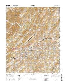
~ Greeneville TN topo map, 1:24000 scale, 7.5 X 7.5 Minute, 2016
Greeneville, Tennessee, USGS topographic map dated 2016.
Includes geographic coordinates (latitude and longitude). This topographic map is suitable for hiking, camping, and exploring, or framing it as a wall map.
Printed on-demand using high resolution imagery, on heavy weight and acid free paper, or alternatively on a variety of synthetic materials.
Topos available on paper, Waterproof, Poly, or Tyvek. Usually shipping rolled, unless combined with other folded maps in one order.
- Product Number: USGS-8018703
- Free digital map download (high-resolution, GeoPDF): Greeneville, Tennessee (file size: 28 MB)
- Map Size: please refer to the dimensions of the GeoPDF map above
- Weight (paper map): ca. 55 grams
- Map Type: POD USGS Topographic Map
- Map Series: US Topo
- Map Verison: Current
- Cell ID: 18387
- Datum: North American Datum of 1983
- Map Projection: Transverse Mercator
- Map Cell Name: Greeneville
- Grid size: 7.5 X 7.5 Minute
- Date on map: 2016
- Map Scale: 1:24000
- Geographical region: Tennessee, United States
Neighboring Maps:
All neighboring USGS topo maps are available for sale online at a variety of scales.
Spatial coverage:
Topo map Greeneville, Tennessee, covers the geographical area associated the following places:
- Mays Subdivision - Dobson Subdivision - Green Acres - Fairview - Honeys Hill - Sunnyside - Windy Hills - Tusculum Place - Heritage Hills - Taylor Acres - Bradburn Hill - Pinecrest - Tanglewood Estates - Summey Subdivision - Home Field Terrace - Derby (historical) - Willis Subdivision - Wilhoit Subdivision - Forest Hills - Tusculum Heights - College Hills - Alexander Mill - Gregory Subdivision - Westgate - Robinson Forest - Williams Subdivision - Rustic Acres - Cedar Hill - Mountain View Terrace - Oak Hills - Rollins Subdivision - Wedgewood Hills - College View - Highland Hills - Meadowlark - Hartman Subdivision - Rockwood Hill - Stowe Acres - Tusculum - Craddock Subdivision - Leming Subdivision - Cherrydale - Harrison Hills - Twin Oaks - Town Acres - Hickory Hills - Holly Hills - Fairfield - Greeneville - Eastview - Buckingham Heights - Bolton Estates - Upchurch - Sunset Acres
- Map Area ID: AREA36.2536.125-82.875-82.75
- Northwest corner Lat/Long code: USGSNW36.25-82.875
- Northeast corner Lat/Long code: USGSNE36.25-82.75
- Southwest corner Lat/Long code: USGSSW36.125-82.875
- Southeast corner Lat/Long code: USGSSE36.125-82.75
- Northern map edge Latitude: 36.25
- Southern map edge Latitude: 36.125
- Western map edge Longitude: -82.875
- Eastern map edge Longitude: -82.75


