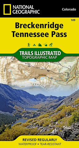
Breckenridge and Tennessee Pass, Colorado, Map 109 by National Geographic Maps
• Waterproof • Tear-Resistant • Topographic Map
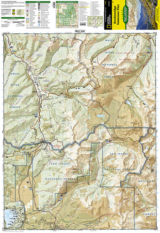
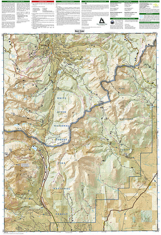
National Geographics Trails Illustrated map of Breckenridge and Tennessee Pass delivers detail and valuable information to assist you in your exploration of this portion of the Continental Divide. Expertly researched and created in partnership with local land management agencies, this map features key points of interest including Turquoise Lake; Blue River; Camp Hale Recreation Area; Breckenridge and Copper Mountain ski resorts; Ski Cooper Ski Area; and portions of Pike, White River, and San Isabel national forests.
With miles of mapped trails including the Colorado and Continental Divide trails, this map can guide you off the beaten path and back again in some of the most breathtaking scenery in the region. Trail mileage between intersections will help you choose the path thats right for you and trail use is clearly marked to denote trails for hiking, cross country skiing, snowmobiling, and biking. The Top of the Rockies scenic byway is noted for those wishing to take in the scenery by car. Some of the many recreation features include campgrounds, trailheads, picnic areas, public recreation cabins, boat launches, and fishing and river access. The map base includes contour lines and elevations for summits, passes and many lakes.
Every Trails Illustrated map is printed on Backcountry Tough waterproof, tear-resistant paper. A full UTM grid is printed on the map to aid with GPS navigation.
Other features found on this map include: Hoosier Pass, Mount Bross, Mount Democrat, Mount Evans, Mount Lincoln, Pike National Forest, Quandary Peak, San Isabel National Forest, Tenmile Range, Tennessee Pass, White River National Forest.
- Product Number: 2144316M
- Product Code: TI_CO_109
- Publisher Product ID: TI00000109
- ISBN: 9781566953221
- Year of Publication: 2013
- Folded Size: 7.48 x 3.94 inches
- Unfolded Size: 26.77 x 21.26 inches
- Map type: Folded Map
- Geographical region: Tennessee