
~ Payson Lakes UT topo map, 1:24000 scale, 7.5 X 7.5 Minute, Current, 2014
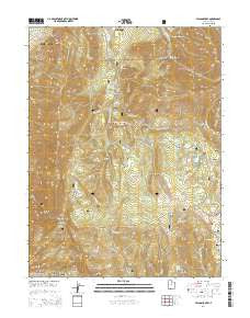
Payson Lakes, Utah, USGS topographic map dated 2014.
Includes geographic coordinates (latitude and longitude). This topographic map is suitable for hiking, camping, and exploring, or framing it as a wall map.
Printed on-demand using high resolution imagery, on heavy weight and acid free paper, or alternatively on a variety of synthetic materials.
Topos available on paper, Waterproof, Poly, or Tyvek. Usually shipping rolled, unless combined with other folded maps in one order.
- Product Number: USGS-7788554
- Free digital map download (high-resolution, GeoPDF): Payson Lakes, Utah (file size: 35 MB)
- Map Size: please refer to the dimensions of the GeoPDF map above
- Weight (paper map): ca. 55 grams
- Map Type: POD USGS Topographic Map
- Map Series: US Topo
- Map Verison: Current
- Cell ID: 34499
- Datum: North American Datum of 1983
- Map Projection: Transverse Mercator
- Map Cell Name: Payson Lakes
- Grid size: 7.5 X 7.5 Minute
- Date on map: 2014
- Map Scale: 1:24000
- Geographical region: Utah, United States
Neighboring Maps:
All neighboring USGS topo maps are available for sale online at a variety of scales.
Spatial coverage:
Topo map Payson Lakes, Utah, covers the geographical area associated the following places:
- Big East Dam - Pete Winward Reservoir - Rock Canyon - Minnie Simmons Spring - Pete Winward Dam - Payson Lakes Campground - Right Fork Loafer Canyon - Left Fork Sullivan Canyon - Sheepherder Hill - Lizard Lake - Big Spring Creek - Camp Koholowo - Rock Spring - McClellan Lake - Dry Mountain - Taylor Fork - Gentle Band Spring - The Gulch - Syndicate Mine - Castle Rock Creek - Mud Hollow - Right Fork Sullivan Canyon - Bennie Creek Ridge - Tinney Flat Campground - Bear Canyon - Mud Spring - Soap Flat - Maple Dell Camp - Dry Lake Reservoir - Maple Bench Campground - Shingle Mill Hollow - Crooked Canyon - Golden Relief Mine - Bellows Hollow - Beaver Dam Overlook - Right Fork Peteeneet Creek - Maple Lake - Payson Lakes - Lower Water Hollow - Dipping Corral Spring - Tie Fork - Jones Ranch Creek - Middle Fork Sullivan Canyon - Sullivan Canyon - Frank Young Canyon - Big East Reservoir - Big Springs - Levi Hollow - McClellan Lake Dam - Santaquin Meadows - Shram Creek - Jumpoff Hollow - Walker Flat - Amos Backbone - Done Ridge - Wimmer Ranch Creek - Calkens Hollow - Tinney Flat - Maple Lake Dam - Kuntz Flat - Coal Pit Creek - Gentle Band Ridge - Dry Lake Dam - Left Fork Loafer Canyon - Dry Hollow - Payson Lake Guard Station - Red Lake - Box Lake - Box Canyon - Blackhawk Campground
- Map Area ID: AREA4039.875-111.75-111.625
- Northwest corner Lat/Long code: USGSNW40-111.75
- Northeast corner Lat/Long code: USGSNE40-111.625
- Southwest corner Lat/Long code: USGSSW39.875-111.75
- Southeast corner Lat/Long code: USGSSE39.875-111.625
- Northern map edge Latitude: 40
- Southern map edge Latitude: 39.875
- Western map edge Longitude: -111.75
- Eastern map edge Longitude: -111.625


