
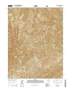
~ Nebo Basin UT topo map, 1:24000 scale, 7.5 X 7.5 Minute, Current, 2014
Nebo Basin, Utah, USGS topographic map dated 2014.
Includes geographic coordinates (latitude and longitude). This topographic map is suitable for hiking, camping, and exploring, or framing it as a wall map.
Printed on-demand using high resolution imagery, on heavy weight and acid free paper, or alternatively on a variety of synthetic materials.
Topos available on paper, Waterproof, Poly, or Tyvek. Usually shipping rolled, unless combined with other folded maps in one order.
- Product Number: USGS-7788300
- Free digital map download (high-resolution, GeoPDF): Nebo Basin, Utah (file size: 36 MB)
- Map Size: please refer to the dimensions of the GeoPDF map above
- Weight (paper map): ca. 55 grams
- Map Type: POD USGS Topographic Map
- Map Series: US Topo
- Map Verison: Current
- Cell ID: 31451
- Datum: North American Datum of 1983
- Map Projection: Transverse Mercator
- Map Cell Name: Nebo Basin
- Grid size: 7.5 X 7.5 Minute
- Date on map: 2014
- Map Scale: 1:24000
- Geographical region: Utah, United States
Neighboring Maps:
All neighboring USGS topo maps are available for sale online at a variety of scales.
Spatial coverage:
Topo map Nebo Basin, Utah, covers the geographical area associated the following places:
- Cottonwood Campground - Bear Canyon - Salamander Lake - Lunt Hollow - Pole Canyon - Andrews Creek - Hop Creek Ridge - Black Canyon - Devils Kitchen - Middle Basin - Salt Spring Creek - Bear Trap Ridge - Nebo Peak Trail - Red Creek Flat - Right Fork Pole Creek - Golden Ridge - Left Fork Salt Creek - Nebo Bench - North Peak - Right Fork Salt Creek - Red Rock Pasture - Kemo Creek - Dry Hollow - Cow Hollow - Middle Fork Pole Creek - Spooner Hollow - Beaver Dam Creek - Andrews Ridge - Trail Pass - Nebo Basin Trail - Hell Hole Basin - Corral Fork - Buck Hollow - Spring Hollow - Mahogany Hill - Left Fork Slab Creek - Tryan Hollow - Summit Trail - Sawmill Fork - Beer Bottle Spring - Left Fork Pole Creek - White Pine Hollow - Evans Ridge - Twin Knolls - Upper Pasture - Holman Creek - Nebo Basin - McCune Canyon - Ponderosa Campground - Bear Canyon Picnic Area - Slab Creek - Red Creek
- Map Area ID: AREA39.87539.75-111.75-111.625
- Northwest corner Lat/Long code: USGSNW39.875-111.75
- Northeast corner Lat/Long code: USGSNE39.875-111.625
- Southwest corner Lat/Long code: USGSSW39.75-111.75
- Southeast corner Lat/Long code: USGSSE39.75-111.625
- Northern map edge Latitude: 39.875
- Southern map edge Latitude: 39.75
- Western map edge Longitude: -111.75
- Eastern map edge Longitude: -111.625


