
~ Ferron Reservoir UT topo map, 1:24000 scale, 7.5 X 7.5 Minute, Current, 2014
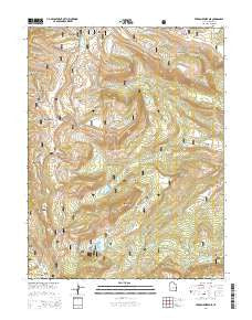
Ferron Reservoir, Utah, USGS topographic map dated 2014.
Includes geographic coordinates (latitude and longitude). This topographic map is suitable for hiking, camping, and exploring, or framing it as a wall map.
Printed on-demand using high resolution imagery, on heavy weight and acid free paper, or alternatively on a variety of synthetic materials.
Topos available on paper, Waterproof, Poly, or Tyvek. Usually shipping rolled, unless combined with other folded maps in one order.
- Product Number: USGS-7786129
- Free digital map download (high-resolution, GeoPDF): Ferron Reservoir, Utah (file size: 34 MB)
- Map Size: please refer to the dimensions of the GeoPDF map above
- Weight (paper map): ca. 55 grams
- Map Type: POD USGS Topographic Map
- Map Series: US Topo
- Map Verison: Current
- Cell ID: 15198
- Datum: North American Datum of 1983
- Map Projection: Transverse Mercator
- Map Cell Name: Ferron Reservoir
- Grid size: 7.5 X 7.5 Minute
- Date on map: 2014
- Map Scale: 1:24000
- Geographical region: Utah, United States
Neighboring Maps:
All neighboring USGS topo maps are available for sale online at a variety of scales.
Spatial coverage:
Topo map Ferron Reservoir, Utah, covers the geographical area associated the following places:
- Twelvemile Flat - Willow Lake - High Top - Willow Lake Dam - Lake Fork Creek - Willow Creek - Rush Pond - Ferron Campground - Georges Fork - Indian Creek - Cold Creek - Little Horse Creek - Ferron Dam - Ferron Campground - Duck Fork Reservoir - Petty Peak - Duck Fork Reservoir - Woodtick Point - Harmonica Point - Jet Fox Reservoir - Duck Fork - Buck Ridge - Ferron Reservoir - Ferron Reservoir Campground - Lake Mountain - Harmonica Lake - Cove Mountain - Mill Stream - Lake Fork - Little South Fork Manti Canyon - Duck Fork Dam - Trail Ridge - Willow Lake Campground - Indian Creek Administrative Site - Willow Bunch - Ferron Reservoir Summer Home Area - Cove Lake - Shoemaker Flat - Windy Point - Singleton Flat - The White Slides - Snow Lake - The Cove
- Map Area ID: AREA39.2539.125-111.5-111.375
- Northwest corner Lat/Long code: USGSNW39.25-111.5
- Northeast corner Lat/Long code: USGSNE39.25-111.375
- Southwest corner Lat/Long code: USGSSW39.125-111.5
- Southeast corner Lat/Long code: USGSSE39.125-111.375
- Northern map edge Latitude: 39.25
- Southern map edge Latitude: 39.125
- Western map edge Longitude: -111.5
- Eastern map edge Longitude: -111.375


