
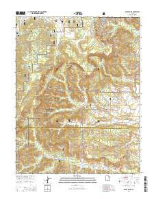
~ Bryce Point UT topo map, 1:24000 scale, 7.5 X 7.5 Minute, Current, 2014
Bryce Point, Utah, USGS topographic map dated 2014.
Includes geographic coordinates (latitude and longitude). This topographic map is suitable for hiking, camping, and exploring, or framing it as a wall map.
Printed on-demand using high resolution imagery, on heavy weight and acid free paper, or alternatively on a variety of synthetic materials.
Topos available on paper, Waterproof, Poly, or Tyvek. Usually shipping rolled, unless combined with other folded maps in one order.
- Product Number: USGS-7785279
- Free digital map download (high-resolution, GeoPDF): Bryce Point, Utah (file size: 44 MB)
- Map Size: please refer to the dimensions of the GeoPDF map above
- Weight (paper map): ca. 55 grams
- Map Type: POD USGS Topographic Map
- Map Series: US Topo
- Map Verison: Current
- Cell ID: 5850
- Datum: North American Datum of 1983
- Map Projection: Transverse Mercator
- Map Cell Name: Bryce Point
- Grid size: 7.5 X 7.5 Minute
- Date on map: 2014
- Map Scale: 1:24000
- Geographical region: Utah, United States
Neighboring Maps:
All neighboring USGS topo maps are available for sale online at a variety of scales.
Spatial coverage:
Topo map Bryce Point, Utah, covers the geographical area associated the following places:
- Swamp Canyon - Mutt and Jeff - Trough Spring - Swamp Canyon Butte - South Hall - Inspiration Point Overlook - The Alligator - Bryce Point Overlook - Katzenjammer Kids - Bridge Creek - The Sentinel - Paria View Overlook - Pagoda - Queens Garden - Bridge Canyon - Mud Canyon Butte - Wall of Windows - Carmel and Wiseman - North Fork Ponderosa Canyon - Short Canyon - Black Birch Canyon - Yellow Spring - Farview Point - North Hall - Hat Shop - Sunset Point - The Cathedral - Temple of Osiris - Turtle - Horse Trail - The Pope - Sheep Creek Flat - Queens Garden Trail - Temples of the Gods - Deer Mountain - Liberty Castle - Piracy Point - Peekaboo Loop Trail - Johnson Ranch - Gullivers Castle - Wall Street - Whiteman Spring - Inspiration Point - Under-the-Rim Trail - Peekaboo Canyon - Sunset Point Overlook - Noon Canyon Butte - Noon Canyon - The Gossips - Swamp Canyon Overlook - Organ Grinders Monkey - Tropic Reservoir - Joseph and Mary - Navajo Loop Trail - Three Wiseman - South Fork Ponderosa Canyon - Mud Canyon - Fairy Castle - Agua Canyon - Henderson Creek - Heward Creek - Alley Oop and Dinny - Pans Pinnacle - Hindu Temples - Whiteman Bench - Bryce Point - Swamp Canyon Connecting Trail - Bristlecone Point - Sheep Creek Connecting Trail - Fairview Natural Bridge - Bryce Canyon - Queen Victoria - Silent City - Sunset Campground - Ponderosa Canyon - Whiteman Connecting Trail - Farview Point Overlook - Merrill Ranch - Bryce Canyon National Park - Two Bridges - Pasture Wash - Piracy Point Overlook - Shaker Spring - Thors Hammer
- Map Area ID: AREA37.62537.5-112.25-112.125
- Northwest corner Lat/Long code: USGSNW37.625-112.25
- Northeast corner Lat/Long code: USGSNE37.625-112.125
- Southwest corner Lat/Long code: USGSSW37.5-112.25
- Southeast corner Lat/Long code: USGSSE37.5-112.125
- Northern map edge Latitude: 37.625
- Southern map edge Latitude: 37.5
- Western map edge Longitude: -112.25
- Eastern map edge Longitude: -112.125


