
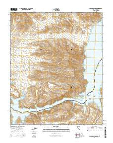
~ Hiller Mountains NV topo map, 1:24000 scale, 7.5 X 7.5 Minute, 2014
Hiller Mountains, Nevada, USGS topographic map dated 2014.
Includes geographic coordinates (latitude and longitude). This topographic map is suitable for hiking, camping, and exploring, or framing it as a wall map.
Printed on-demand using high resolution imagery, on heavy weight and acid free paper, or alternatively on a variety of synthetic materials.
Topos available on paper, Waterproof, Poly, or Tyvek. Usually shipping rolled, unless combined with other folded maps in one order.
- Product Number: USGS-7172612
- Free digital map download (high-resolution, GeoPDF): Hiller Mountains, Nevada (file size: 26 MB)
- Map Size: please refer to the dimensions of the GeoPDF map above
- Weight (paper map): ca. 55 grams
- Map Type: POD USGS Topographic Map
- Map Series: US Topo
- Map Verison: Current
- Cell ID: 20461
- Datum: North American Datum of 1983
- Map Projection: Transverse Mercator
- Map Cell Name: Hiller Mountains
- Grid size: 7.5 X 7.5 Minute
- Date on map: 2014
- Map Scale: 1:24000
- Geographical region: Nevada, United States
Neighboring Maps:
All neighboring USGS topo maps are available for sale online at a variety of scales.
Spatial coverage:
Topo map Hiller Mountains, Nevada, covers the geographical area associated the following places:
- Gold Cross Bay - Greggs Hideout - Burro Bay - Spring Cove - Wild Burro Wash - Eureka Mine - Scanlon Wash - Rocky Point - Hiller Mountains - Channel Reef - Channel Bay - Old Senator Mill (historical) - Scanlon Bay - Smith Ranch (historical) - Reef Bay - Black Box - Burro Spring - Gregg Peak - Temple Mesa - Little Burro Bay - Hualpai Rapids (historical) - Channel Island - Spring Canyon - Jumbo Mine - Gregg Wash - Union Mine - Powell Bay - Round Rock Point - Joker Mine - Jumbo Pass - Greggs Ferry (historical) - Hualapai Bay - Powell Mountain - Hualapai Wash - Virgin Reef - Gregg Basin - Salt Spring Bay - Slide Cove - Hualapai Island - Granite Cove - Scanlon Hill - Gold Cross Peak
- Map Area ID: AREA36.12536-114.25-114.125
- Northwest corner Lat/Long code: USGSNW36.125-114.25
- Northeast corner Lat/Long code: USGSNE36.125-114.125
- Southwest corner Lat/Long code: USGSSW36-114.25
- Southeast corner Lat/Long code: USGSSE36-114.125
- Northern map edge Latitude: 36.125
- Southern map edge Latitude: 36
- Western map edge Longitude: -114.25
- Eastern map edge Longitude: -114.125


