
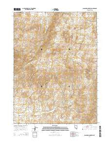
~ Blanchard Mountain NV topo map, 1:24000 scale, 7.5 X 7.5 Minute, 2014
Blanchard Mountain, Nevada, USGS topographic map dated 2014.
Includes geographic coordinates (latitude and longitude). This topographic map is suitable for hiking, camping, and exploring, or framing it as a wall map.
Printed on-demand using high resolution imagery, on heavy weight and acid free paper, or alternatively on a variety of synthetic materials.
Topos available on paper, Waterproof, Poly, or Tyvek. Usually shipping rolled, unless combined with other folded maps in one order.
- Product Number: USGS-7171056
- Free digital map download (high-resolution, GeoPDF): Blanchard Mountain, Nevada (file size: 24 MB)
- Map Size: please refer to the dimensions of the GeoPDF map above
- Weight (paper map): ca. 55 grams
- Map Type: POD USGS Topographic Map
- Map Series: US Topo
- Map Verison: Current
- Cell ID: 4340
- Datum: North American Datum of 1983
- Map Projection: Transverse Mercator
- Map Cell Name: Blanchard Mountain
- Grid size: 7.5 X 7.5 Minute
- Date on map: 2014
- Map Scale: 1:24000
- Geographical region: Nevada, United States
Neighboring Maps:
All neighboring USGS topo maps are available for sale online at a variety of scales.
Spatial coverage:
Topo map Blanchard Mountain, Nevada, covers the geographical area associated the following places:
- Willow Spring - Babel Mine - Rose O'Connell Mine - China Mountain Spring - Vulcan Mine - Knoll Creek Springs - White Peaks - Hice Mine - Babel (historical) - Alabama (historical) - Miller Canyon - Granite Range - Chinaman Mine - Turo Mine - High Ore Mine - Hanks Creek - Apollo Five Mine - Arizona Mine - Hanks Peak - Quilici Creek - Agort Pass - Noh Springs - Bloody Gulch - Knoll Creek Experimental Station - University of Nevada - Contact Mining District - Ohio Gulch - Granite Peak - Lower Alabama (historical) - Hanks Mine - Bricker Mine - Blanchard Mountain - Blanchard Mine - Johnson Mine - War Eagle Mine - Silver Star Mine - Valder Creek
- Map Area ID: AREA41.7541.625-114.75-114.625
- Northwest corner Lat/Long code: USGSNW41.75-114.75
- Northeast corner Lat/Long code: USGSNE41.75-114.625
- Southwest corner Lat/Long code: USGSSW41.625-114.75
- Southeast corner Lat/Long code: USGSSE41.625-114.625
- Northern map edge Latitude: 41.75
- Southern map edge Latitude: 41.625
- Western map edge Longitude: -114.75
- Eastern map edge Longitude: -114.625


