
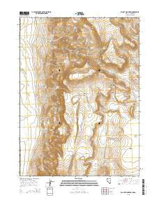
~ Big Hat Mountain NV topo map, 1:24000 scale, 7.5 X 7.5 Minute, 2015
Big Hat Mountain, Nevada, USGS topographic map dated 2015.
Includes geographic coordinates (latitude and longitude). This topographic map is suitable for hiking, camping, and exploring, or framing it as a wall map.
Printed on-demand using high resolution imagery, on heavy weight and acid free paper, or alternatively on a variety of synthetic materials.
Topos available on paper, Waterproof, Poly, or Tyvek. Usually shipping rolled, unless combined with other folded maps in one order.
- Product Number: USGS-7170970
- Free digital map download (high-resolution, GeoPDF): Big Hat Mountain, Nevada (file size: 22 MB)
- Map Size: please refer to the dimensions of the GeoPDF map above
- Weight (paper map): ca. 55 grams
- Map Type: POD USGS Topographic Map
- Map Series: US Topo
- Map Verison: Current
- Cell ID: 3724
- Datum: North American Datum of 1983
- Map Projection: Transverse Mercator
- Map Cell Name: Big Hat Mountain
- Grid size: 7.5 X 7.5 Minute
- Date on map: 2015
- Map Scale: 1:24000
- Geographical region: Nevada, United States
Neighboring Maps:
All neighboring USGS topo maps are available for sale online at a variety of scales.
Spatial coverage:
Topo map Big Hat Mountain, Nevada, covers the geographical area associated the following places:
- North Spring - Bull Springs - Big Spring - Black Canyon - Miller Ranch - Long Ranch - Dry Well - Roe Deer Spring - Small Spring - Willow Springs - Black Canyon Reservoir - Crampton Troughs - Hog Gulch - Rimrock Spring - South Willow Creek - The Craters - South Spring - Big Hat Mountain - Rock Spring - Dip Spring - Table Lakes - Drag Road Canyon - Long Lake
- Map Area ID: AREA41.541.375-120-119.875
- Northwest corner Lat/Long code: USGSNW41.5-120
- Northeast corner Lat/Long code: USGSNE41.5-119.875
- Southwest corner Lat/Long code: USGSSW41.375-120
- Southeast corner Lat/Long code: USGSSE41.375-119.875
- Northern map edge Latitude: 41.5
- Southern map edge Latitude: 41.375
- Western map edge Longitude: -120
- Eastern map edge Longitude: -119.875


