
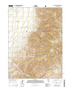
~ Water Pipe Canyon NV topo map, 1:24000 scale, 7.5 X 7.5 Minute, 2015
Water Pipe Canyon, Nevada, USGS topographic map dated 2015.
Includes geographic coordinates (latitude and longitude). This topographic map is suitable for hiking, camping, and exploring, or framing it as a wall map.
Printed on-demand using high resolution imagery, on heavy weight and acid free paper, or alternatively on a variety of synthetic materials.
Topos available on paper, Waterproof, Poly, or Tyvek. Usually shipping rolled, unless combined with other folded maps in one order.
- Product Number: USGS-7169899
- Free digital map download (high-resolution, GeoPDF): Water Pipe Canyon, Nevada (file size: 24 MB)
- Map Size: please refer to the dimensions of the GeoPDF map above
- Weight (paper map): ca. 55 grams
- Map Type: POD USGS Topographic Map
- Map Series: US Topo
- Map Verison: Current
- Cell ID: 47645
- Datum: North American Datum of 1983
- Map Projection: Transverse Mercator
- Map Cell Name: Water Pipe Canyon
- Grid size: 7.5 X 7.5 Minute
- Date on map: 2015
- Map Scale: 1:24000
- Geographical region: Nevada, United States
Neighboring Maps:
All neighboring USGS topo maps are available for sale online at a variety of scales.
Spatial coverage:
Topo map Water Pipe Canyon, Nevada, covers the geographical area associated the following places:
- Happy Camp - Taylor Canyon - Jack Henry Canyon - Thomas Jose Canyon - Independence Valley - Coyote Creek - Carlin Creek - Mill Creek - Wheeler Mountain - Schmidt Creek - Coal Creek - Van Norman Ranch - Williams Ranch - Coyote Canyon - Barrel Spring - Dry Creek - Calamity Ranch - Italian Spring Creek - Basin Burns Mine - Starvation Canyon - Doheny Ranch - Willow Spring - Rocky Canyon - Independence Valley Volunteer Fire Department - Sixmile Creek
- Map Area ID: AREA41.37541.25-116.125-116
- Northwest corner Lat/Long code: USGSNW41.375-116.125
- Northeast corner Lat/Long code: USGSNE41.375-116
- Southwest corner Lat/Long code: USGSSW41.25-116.125
- Southeast corner Lat/Long code: USGSSE41.25-116
- Northern map edge Latitude: 41.375
- Southern map edge Latitude: 41.25
- Western map edge Longitude: -116.125
- Eastern map edge Longitude: -116


