
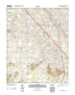
~ Murfreesboro TN topo map, 1:24000 scale, 7.5 X 7.5 Minute, Historical, 2013
Murfreesboro, Tennessee, USGS topographic map dated 2013.
Includes geographic coordinates (latitude and longitude). This topographic map is suitable for hiking, camping, and exploring, or framing it as a wall map.
Printed on-demand using high resolution imagery, on heavy weight and acid free paper, or alternatively on a variety of synthetic materials.
Topos available on paper, Waterproof, Poly, or Tyvek. Usually shipping rolled, unless combined with other folded maps in one order.
- Product Number: USGS-5944176
- Free digital map download (high-resolution, GeoPDF): Murfreesboro, Tennessee (file size: 26 MB)
- Map Size: please refer to the dimensions of the GeoPDF map above
- Weight (paper map): ca. 55 grams
- Map Type: POD USGS Topographic Map
- Map Series: US Topo
- Map Verison: Historical
- Cell ID: 31145
- Datum: North American Datum of 1983
- Map Projection: Transverse Mercator
- Map Cell Name: Murfreesboro
- Grid size: 7.5 X 7.5 Minute
- Date on map: 2013
- Map Scale: 1:24000
- Geographical region: Tennessee, United States
Neighboring Maps:
All neighboring USGS topo maps are available for sale online at a variety of scales.
Spatial coverage:
Topo map Murfreesboro, Tennessee, covers the geographical area associated the following places:
- Barfield - Murfreesboro - Manson Manor - Glaze - Joyceland - Salem - Manson Park - K C Subdivision - Mount Olive (historical) - Brownview Acres - Broodwood - Country Park - Mount View Estates - Barfield Meadows - Southern Aire - Brookhill - Southwood Estates - Palmer Acres South - Rucker - Winstead (historical) - Ridgefield - Battleground Estates - Oakwood - Beasley Road - Crescent - Glendale - Butler Estates - River Shores - Watson - Parkwood Estates - Kimbro Heights - Deerfield - Jernigan Subdivision - Meadow Lane - Dixieland - Riverdale - Creekwood - Overall - Old South Estates - Paschal Estates - Hickory Hills - Franklin Road Estates - Stonebrook - Green Meadows
- Map Area ID: AREA35.87535.75-86.5-86.375
- Northwest corner Lat/Long code: USGSNW35.875-86.5
- Northeast corner Lat/Long code: USGSNE35.875-86.375
- Southwest corner Lat/Long code: USGSSW35.75-86.5
- Southeast corner Lat/Long code: USGSSE35.75-86.375
- Northern map edge Latitude: 35.875
- Southern map edge Latitude: 35.75
- Western map edge Longitude: -86.5
- Eastern map edge Longitude: -86.375


