
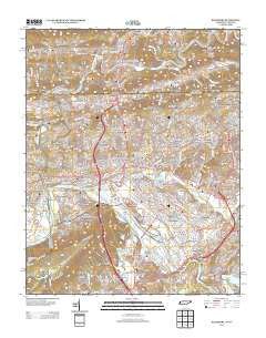
~ Kingsport TN topo map, 1:24000 scale, 7.5 X 7.5 Minute, Historical, 2013
Kingsport, Tennessee, USGS topographic map dated 2013.
Includes geographic coordinates (latitude and longitude). This topographic map is suitable for hiking, camping, and exploring, or framing it as a wall map.
Printed on-demand using high resolution imagery, on heavy weight and acid free paper, or alternatively on a variety of synthetic materials.
Topos available on paper, Waterproof, Poly, or Tyvek. Usually shipping rolled, unless combined with other folded maps in one order.
- Product Number: USGS-5943174
- Free digital map download (high-resolution, GeoPDF): Kingsport, Tennessee (file size: 35 MB)
- Map Size: please refer to the dimensions of the GeoPDF map above
- Weight (paper map): ca. 55 grams
- Map Type: POD USGS Topographic Map
- Map Series: US Topo
- Map Verison: Historical
- Cell ID: 23648
- Datum: North American Datum of 1983
- Map Projection: Transverse Mercator
- Map Cell Name: Kingsport
- Grid size: 7.5 X 7.5 Minute
- Date on map: 2013
- Map Scale: 1:24000
- Geographical region: Tennessee, United States
Neighboring Maps:
All neighboring USGS topo maps are available for sale online at a variety of scales.
Spatial coverage:
Topo map Kingsport, Tennessee, covers the geographical area associated the following places:
- Sunset Hills - Doran Addition - Nelsontown - Rotherwood - Fair Acres - Howard Hill - Darlington Heights - Morrison City - Windmere - Holston Heights - Rotherwood Heights - Preston Forest - Winegar Mill - Thomas Addition - Beechwood Village - Lynn Garden - Yuma - West View Park - Dorter Mill - Petlier (historical) - Fox Run - East Kingsport - Gibsontown - Litz Manor - Riverview - Horace (historical) - Amersham - Ridgefields - Beartown - Fort Robinson - Cloud Ford - Midfields - Greenvale - Green Acres - Huntington Hills - Highland Park - Greenfields - Northcott - Holston Hills - Eden Ridge (historical) - Rotherwood Hills - Cherokee Village - Harmony Hills - Springdale - Hemlock Park - Weber City - Larkspur - Kingsport - Sevier Terrace - Long Island - Bloomington Heights - Borden Village - Hiara Heights - Cedar Grove - Skyview Estates - Cliffside
- Map Area ID: AREA36.62536.5-82.625-82.5
- Northwest corner Lat/Long code: USGSNW36.625-82.625
- Northeast corner Lat/Long code: USGSNE36.625-82.5
- Southwest corner Lat/Long code: USGSSW36.5-82.625
- Southeast corner Lat/Long code: USGSSE36.5-82.5
- Northern map edge Latitude: 36.625
- Southern map edge Latitude: 36.5
- Western map edge Longitude: -82.625
- Eastern map edge Longitude: -82.5


