
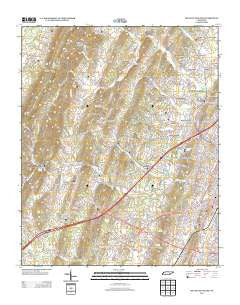
~ South Cleveland TN topo map, 1:24000 scale, 7.5 X 7.5 Minute, Historical, 2013
South Cleveland, Tennessee, USGS topographic map dated 2013.
Includes geographic coordinates (latitude and longitude). This topographic map is suitable for hiking, camping, and exploring, or framing it as a wall map.
Printed on-demand using high resolution imagery, on heavy weight and acid free paper, or alternatively on a variety of synthetic materials.
Topos available on paper, Waterproof, Poly, or Tyvek. Usually shipping rolled, unless combined with other folded maps in one order.
- Product Number: USGS-5942183
- Free digital map download (high-resolution, GeoPDF): South Cleveland, Tennessee (file size: 36 MB)
- Map Size: please refer to the dimensions of the GeoPDF map above
- Weight (paper map): ca. 55 grams
- Map Type: POD USGS Topographic Map
- Map Series: US Topo
- Map Verison: Historical
- Cell ID: 71665
- Datum: North American Datum of 1983
- Map Projection: Transverse Mercator
- Map Cell Name: South Cleveland
- Grid size: 7.5 X 7.5 Minute
- Date on map: 2013
- Map Scale: 1:24000
- Geographical region: Tennessee, United States
Neighboring Maps:
All neighboring USGS topo maps are available for sale online at a variety of scales.
Spatial coverage:
Topo map South Cleveland, Tennessee, covers the geographical area associated the following places:
- Northwest Acres - Hopewell Estates - Eureka Hills - Davis Heights - Villa Heights - Westview Heights - Laurel Ridge - Freewill - Ridgewood - Meadowview - Brentwood Estates - Laurel Valley - Bent Tree Acres - Hills and Dales - Countryside Village - Prospect - Cleveland - Hope Acres - South Rolling Hills - Annadale - Varnell Estates - Lee Estates - Hidden Valley - Rolling Hills - Jacen Gorbett Subdivision - Mountainbrook - Bigsby Creek Estates - Imperial Group Subdivision - Laurel Springs - Baugh Spring - Overbrook - Hopewell
- Map Area ID: AREA35.2535.125-85-84.875
- Northwest corner Lat/Long code: USGSNW35.25-85
- Northeast corner Lat/Long code: USGSNE35.25-84.875
- Southwest corner Lat/Long code: USGSSW35.125-85
- Southeast corner Lat/Long code: USGSSE35.125-84.875
- Northern map edge Latitude: 35.25
- Southern map edge Latitude: 35.125
- Western map edge Longitude: -85
- Eastern map edge Longitude: -84.875


