
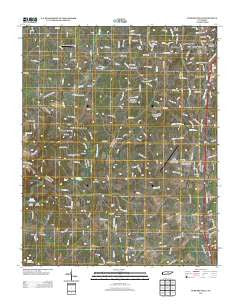
~ Burgess Falls TN topo map, 1:24000 scale, 7.5 X 7.5 Minute, Historical, 2013
Burgess Falls, Tennessee, USGS topographic map dated 2013.
Includes geographic coordinates (latitude and longitude). This topographic map is suitable for hiking, camping, and exploring, or framing it as a wall map.
Printed on-demand using high resolution imagery, on heavy weight and acid free paper, or alternatively on a variety of synthetic materials.
Topos available on paper, Waterproof, Poly, or Tyvek. Usually shipping rolled, unless combined with other folded maps in one order.
- Product Number: USGS-5940657
- Free digital map download (high-resolution, GeoPDF): Burgess Falls, Tennessee (file size: 31 MB)
- Map Size: please refer to the dimensions of the GeoPDF map above
- Weight (paper map): ca. 55 grams
- Map Type: POD USGS Topographic Map
- Map Series: US Topo
- Map Verison: Historical
- Cell ID: 6239
- Datum: North American Datum of 1983
- Map Projection: Transverse Mercator
- Map Cell Name: Burgess Falls
- Grid size: 7.5 X 7.5 Minute
- Date on map: 2013
- Map Scale: 1:24000
- Geographical region: Tennessee, United States
Neighboring Maps:
All neighboring USGS topo maps are available for sale online at a variety of scales.
Spatial coverage:
Topo map Burgess Falls, Tennessee, covers the geographical area associated the following places:
- Samaria - Boiling Springs - Huntland - O'Conner - Pine Hills - Hillrose - Bunker Hill Park - Macedonia - Gibson Subdivision - Southtown Village - Bussell - Wilhite - Window Cliff Estates - Heathwood - Burgess - Campbell - Ditty - South Creek - Town and Country Estates - Twin Oak - Amber Meadows - Colonial Forest - Hamptons Crossroads - Lakeland Park - Colonial Estates - Bakers Crossroads
- Map Area ID: AREA36.12536-85.625-85.5
- Northwest corner Lat/Long code: USGSNW36.125-85.625
- Northeast corner Lat/Long code: USGSNE36.125-85.5
- Southwest corner Lat/Long code: USGSSW36-85.625
- Southeast corner Lat/Long code: USGSSE36-85.5
- Northern map edge Latitude: 36.125
- Southern map edge Latitude: 36
- Western map edge Longitude: -85.625
- Eastern map edge Longitude: -85.5


