
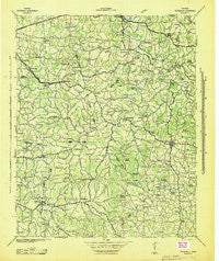
~ Statesville TN topo map, 1:100000 scale, 30 X 30 Minute, Historical, 1942
Statesville, Tennessee, USGS topographic map dated 1942.
Includes geographic coordinates (latitude and longitude). This topographic map is suitable for hiking, camping, and exploring, or framing it as a wall map.
Printed on-demand using high resolution imagery, on heavy weight and acid free paper, or alternatively on a variety of synthetic materials.
Topos available on paper, Waterproof, Poly, or Tyvek. Usually shipping rolled, unless combined with other folded maps in one order.
- Product Number: USGS-5689676
- Free digital map download (high-resolution, GeoPDF): Statesville, Tennessee (file size: 11 MB)
- Map Size: please refer to the dimensions of the GeoPDF map above
- Weight (paper map): ca. 55 grams
- Map Type: POD USGS Topographic Map
- Map Series: HTMC
- Map Verison: Historical
- Cell ID: 396064
- Scan ID: 155953
- Woodland Tint: Yes
- Aerial Photo Year: 1938
- Datum: NAD27
- Map Projection: Polyconic
- Advance: Yes
- Planimetric: Yes
- Map published by United States Army Corps of Engineers
- Map published by United States Department of War
- Map Language: English
- Scanner Resolution: 600 dpi
- Map Cell Name: Statesville
- Grid size: 30 X 30 Minute
- Date on map: 1942
- Map Scale: 1:100000
- Geographical region: Tennessee, United States
Neighboring Maps:
All neighboring USGS topo maps are available for sale online at a variety of scales.
Spatial coverage:
Topo map Statesville, Tennessee, covers the geographical area associated the following places:
- New Middleton - Prospect Hill (historical) - Talome (historical) - Burt - Bratchers Crossroads - Bethlehem (historical) - Stringtown - Helton - Readyville - Bluhmtown - Temperance Hall - Cross Roads - Jones Chapel (historical) - Mount Ararat - Blanton (historical) - Bluff Springs - Club Springs - Mount Sterling (historical) - Norene - Round Top - Buffalo Valley - Greenwood - Auburntown - Ewingsville (historical) - Thomas Town (historical) - Youngblood (historical) - South Carthage - Laurel Hill - Jimtown (historical) - Half Acre - Bethel - Woods - Gassaway - Womack - Rabbit Bluff (historical) - Gloriana (historical) - Cherry Valley - Liberty Hill - Sunny Slope - Pleasant Ridge - Midway - Saulsbury - Carthage Junction - Culpepper - Buckner - Tuckers Crossroads - Center Hill - New Hope - Spring Creek (historical) - Leoni - Stewart Chapel - Brush Creek - Stonewall - Elkins (historical) - Statesville - Elmwood - Evanston (historical) - Magnum (historical) - Oregon (historical) - Gath - Sugar Tree Knob - Alexandria - Pisgah - Earleyville - Lucky - Linwood - Blue Hill - Flat Rock - Bear Branch (historical) - Hickman - Dibrell - Green Hill - Watertown - Haleville (historical) - Woodbury - Flatwood - Cateston - Commerce - Lancaster Hill - Halls Hill - Center Hill (historical) - Pekin (historical) - Blue Springs - Iconium - Cross Roads - Cottage Home - Sheybogan - Caney Fork - Snows Hill - Liberty - Curlee - Berea (historical) - Greenvale - Chestnut Mound - Prosperity - Watkins - Porterfield - Mahone (historical) - Bluewing - Jennings (historical)
- Map Area ID: AREA36.2535.75-86.25-85.75
- Northwest corner Lat/Long code: USGSNW36.25-86.25
- Northeast corner Lat/Long code: USGSNE36.25-85.75
- Southwest corner Lat/Long code: USGSSW35.75-86.25
- Southeast corner Lat/Long code: USGSSE35.75-85.75
- Northern map edge Latitude: 36.25
- Southern map edge Latitude: 35.75
- Western map edge Longitude: -86.25
- Eastern map edge Longitude: -85.75


