
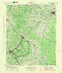
~ Mc Minnville TN topo map, 1:100000 scale, 30 X 30 Minute, Historical, 1943, updated 1944
Mc Minnville, Tennessee, USGS topographic map dated 1943.
Includes geographic coordinates (latitude and longitude). This topographic map is suitable for hiking, camping, and exploring, or framing it as a wall map.
Printed on-demand using high resolution imagery, on heavy weight and acid free paper, or alternatively on a variety of synthetic materials.
Topos available on paper, Waterproof, Poly, or Tyvek. Usually shipping rolled, unless combined with other folded maps in one order.
- Product Number: USGS-5689658
- Free digital map download (high-resolution, GeoPDF): Mc Minnville, Tennessee (file size: 11 MB)
- Map Size: please refer to the dimensions of the GeoPDF map above
- Weight (paper map): ca. 55 grams
- Map Type: POD USGS Topographic Map
- Map Series: HTMC
- Map Verison: Historical
- Cell ID: 396042
- Scan ID: 150199
- Imprint Year: 1944
- Woodland Tint: Yes
- Edit Year: 1944
- Datum: NAD27
- Map Projection: Polyconic
- Map published by United States Army Corps of Engineers
- Map published by United States Department of War
- Map Language: English
- Scanner Resolution: 600 dpi
- Map Cell Name: Mc Minnville
- Grid size: 30 X 30 Minute
- Date on map: 1943
- Map Scale: 1:100000
- Geographical region: Tennessee, United States
Neighboring Maps:
All neighboring USGS topo maps are available for sale online at a variety of scales.
Spatial coverage:
Topo map Mc Minnville, Tennessee, covers the geographical area associated the following places:
- Summerfield - White Oaks - Riley Creek (historical) - Elkins - West Meade - Oak Grove - Westwood Homes - Oak Grove - Bradyville - Melrose Park - Stephenson - Center Grove - Brooksville (historical) - Town And Country Mobile Home Park - Bethany - Calls - Hillcrest - Faulkner Springs - Glenview - Dixie (historical) - Mount Zion - Sainville - Providence - Hillsboro - Yager - Bryan Mill - New (historical) - Ragsdale Road Mobile Home Park - Oak Park - Sevenmile Hill - Westside Heights - Black Jack - Taylor Creek West Subdivision - Piedmont - Rocky Point (historical) - Burgen - Gossburg - Hickory Hill Estates - Bergmantown - Hubbards Cove - Naola (historical) - Mount Leo - Taylor Creek East Subdivision - Summitville - Chestnut Grove - Fairview - Lawson Mill - Bates Hill - Hiawassee - Parker Hill - Crisp Spring - Fountain Grove - Centertown - Belmont - Southgate Park - Westwood - Hoodoo - Ragsdale - Pelham - Fudgearound - McMahan - Payne Cove - Red Hill - Homaway Village - Glen - Johnstown - Briarwood - Tara Estates - Farrar Hill - Pleasant View - Tullahoma - Northcutts Cove - Morrison - Bobs Cross Roads (historical) - Green Acres Mobile Home Park - Lake Hills - Busy Corner - Shady Grove - Forest Mill - Amity - Hixon - Donnell Chapel - Flowertown - Sartain Springs - Winton Town - Ivy Bluff - Strauss Mill - Hanlan (historical) - Alto - Mud Creek - Sharondale - West Riverside - Wilder Chapel - Penile Hill - Manchester Mobile Home Park - Capitol Hill - Pleasant Grove - Clearmont - Tolbertsville (historical) - Midway
- Map Area ID: AREA35.7535.25-86.25-85.75
- Northwest corner Lat/Long code: USGSNW35.75-86.25
- Northeast corner Lat/Long code: USGSNE35.75-85.75
- Southwest corner Lat/Long code: USGSSW35.25-86.25
- Southeast corner Lat/Long code: USGSSE35.25-85.75
- Northern map edge Latitude: 35.75
- Southern map edge Latitude: 35.25
- Western map edge Longitude: -86.25
- Eastern map edge Longitude: -85.75


