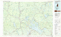
~ Lake Winnipesaukee NH topo map, 1:100000 scale, 30 X 60 Minute, Historical, 1986, updated 1986
Lake Winnipesaukee, New Hampshire, USGS topographic map dated 1986.
Includes geographic coordinates (latitude and longitude). This topographic map is suitable for hiking, camping, and exploring, or framing it as a wall map.
Printed on-demand using high resolution imagery, on heavy weight and acid free paper, or alternatively on a variety of synthetic materials.
Topos available on paper, Waterproof, Poly, or Tyvek. Usually shipping rolled, unless combined with other folded maps in one order.
- Product Number: USGS-5680287
- Free digital map download (high-resolution, GeoPDF): Lake Winnipesaukee, New Hampshire (file size: 20 MB)
- Map Size: please refer to the dimensions of the GeoPDF map above
- Weight (paper map): ca. 55 grams
- Map Type: POD USGS Topographic Map
- Map Series: HTMC
- Map Verison: Historical
- Cell ID: 67805
- Scan ID: 460055
- Imprint Year: 1986
- Woodland Tint: Yes
- Aerial Photo Year: 1983
- Edit Year: 1986
- Datum: NAD27
- Map Projection: Universal Transverse Mercator
- Planimetric: Yes
- Map published by United States Geological Survey
- Map Language: English
- Scanner Resolution: 600 dpi
- Map Cell Name: Lake Winnipesaukee
- Grid size: 30 X 60 Minute
- Date on map: 1986
- Map Scale: 1:100000
- Geographical region: New Hampshire, United States
Neighboring Maps:
All neighboring USGS topo maps are available for sale online at a variety of scales.
Spatial coverage:
Topo map Lake Winnipesaukee, New Hampshire, covers the geographical area associated the following places:
- Laconia - Meredith - Big Rock Corner - Rumney - Spring Haven - Gaza - Woodstock - Sanbornville - West Alton - Brookhurst - North Dorchester - East Alton - South Alexandria - Whittier - Chocorua - Gilford - Ossipee Lake Shores - Whiteface - Bucks Corner - Effingham Falls - Madison - Stockbridge Corner - Ferncroft - Pequawket - Union Wharf - South Conway - Ossipee - Plymouth - Wentworth Hill - New Portsmouth - Paugus Mill - Glencliff - Elmwood - Chicks Corner - Roland Park - West Thornton - Pollys Crossing - Woodlands - Weirs Beach - Hebron - North Sandwich - East Wakefield - Eaton Center - Waterville Valley - Meredith Hill - Center Effingham - West Rumney - Grafton - Mount Major - Yale Estates - Fords Mill - Goose Hollow - Grafton Center - Freedom - East Sandwich - Tuftonboro - Center Harbor - Clark Landing - Wawbeek - Silver Lake - Dockham Shore - Ellsworth - Campton Station - New Hampton - Quincy - Alexandria - Chases Mill - Hill - Wolfeboro - Dorrs Corner - East Holderness - Sandwich - Campton Lower Village - Warren - Hill Center - East Grafton - Interlaken Park - Keewayden - Danbury - Rumney Depot - Center Tuftonboro - Center Sandwich - Gilmans Corner - East Madison - Moultonborough Falls - Grape Corner - Long Sands - West Center Harbor - West Ossipee - Rockywold - Winnisquam - Robinson Corner - Lake Shore Park - Quint - Breezy Point - Lees Mill - Mallard Cove - South Tamworth - East Hebron - Nuttings Beach
- Map Area ID: AREA4443.5-72-71
- Northwest corner Lat/Long code: USGSNW44-72
- Northeast corner Lat/Long code: USGSNE44-71
- Southwest corner Lat/Long code: USGSSW43.5-72
- Southeast corner Lat/Long code: USGSSE43.5-71
- Northern map edge Latitude: 44
- Southern map edge Latitude: 43.5
- Western map edge Longitude: -72
- Eastern map edge Longitude: -71