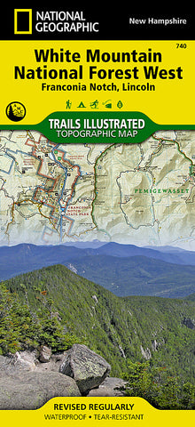
Franconia Notch, Lincon, Western White Mountains Natl Forest, Map 740 by National Geographic Maps
Click to Zoom (high resolution)
• Waterproof • Tear-Resistant • Topographic Map
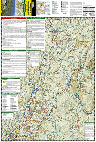
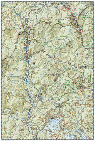
Coverage area includes White Mountain National Forest; Pemigewasset and Sandwich Range wilderness areas; Appalachian National Scenic Trail from Hanover, NH to Crawford Notch State Park; Franconia Notch and Echo Lake state parks; Kancamagus Highway, Tripoli Road, and Bear Notch Road. Also includes Plymouth, Rumney, Lincoln, Twin Mountain, North Conway and Wonalancet. Includes UTM grids for use with your GPS unit and a trail mileage matrix.
Map Scale = 1:70,000
- Product Number: 2034607M
- Product Code: TI_FRANCONIA
- Publisher Product ID: TI00000740
- ISBN: 9781566954655
- Year of Publication: 2011
- Folded Size: 9.45 x 4.33 inches
- Unfolded Size: 37.01 x 24.8 inches
- Map type: Folded Map
- Geographical region: New Hampshire