
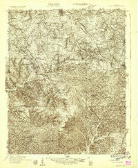
~ Ridgetop TN topo map, 1:48000 scale, 15 X 15 Minute, Historical, 1931, updated 1957
Ridgetop, Tennessee, USGS topographic map dated 1931.
Includes geographic coordinates (latitude and longitude). This topographic map is suitable for hiking, camping, and exploring, or framing it as a wall map.
Printed on-demand using high resolution imagery, on heavy weight and acid free paper, or alternatively on a variety of synthetic materials.
Topos available on paper, Waterproof, Poly, or Tyvek. Usually shipping rolled, unless combined with other folded maps in one order.
- Product Number: USGS-5659486
- Free digital map download (high-resolution, GeoPDF): Ridgetop, Tennessee (file size: 20 MB)
- Map Size: please refer to the dimensions of the GeoPDF map above
- Weight (paper map): ca. 55 grams
- Map Type: POD USGS Topographic Map
- Map Series: HTMC
- Map Verison: Historical
- Cell ID: 61614
- Scan ID: 153370
- Imprint Year: 1957
- Survey Year: 1931
- Datum: NAD
- Map Projection: Polyconic
- Advance: Yes
- Map published by United States Geological Survey
- Keywords: Nonstandard Press Run; Overedge
- Map Language: English
- Scanner Resolution: 600 dpi
- Map Cell Name: Ridgetop
- Grid size: 15 X 15 Minute
- Date on map: 1931
- Map Scale: 1:48000
- Geographical region: Tennessee, United States
Neighboring Maps:
All neighboring USGS topo maps are available for sale online at a variety of scales.
Spatial coverage:
Topo map Ridgetop, Tennessee, covers the geographical area associated the following places:
- Greenbrier - Joelton - Coopertown - Bearwallow - Addie (historical) - Crunk - Pinnacle - Ivy Point - Hygeia Springs - Germantown - Ridgepost (historical) - Westeria (historical) - Mount Zion - Whites Creek - Bakers - Glover Crossroad - Little Creek - Chestnut Grove - Whites Creek Springs (historical) - Dalemere - Forest Grove - Hoffasville (historical) - Lickton - Dry Fork (historical) - Williams Hills - Bellshire - Rest (historical) - Morny - Union Hill - Chestnut Orchard - West - Courtland - Perry Park - Flewellyn - Ridgetop - Greenville
- Map Area ID: AREA36.536.25-87-86.75
- Northwest corner Lat/Long code: USGSNW36.5-87
- Northeast corner Lat/Long code: USGSNE36.5-86.75
- Southwest corner Lat/Long code: USGSSW36.25-87
- Southeast corner Lat/Long code: USGSSE36.25-86.75
- Northern map edge Latitude: 36.5
- Southern map edge Latitude: 36.25
- Western map edge Longitude: -87
- Eastern map edge Longitude: -86.75


