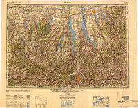
~ Elmira NY topo map, 1:250000 scale, 1 X 2 Degree, Historical, 1950, updated 1950
Elmira, New York, USGS topographic map dated 1950.
Includes geographic coordinates (latitude and longitude). This topographic map is suitable for hiking, camping, and exploring, or framing it as a wall map.
Printed on-demand using high resolution imagery, on heavy weight and acid free paper, or alternatively on a variety of synthetic materials.
Topos available on paper, Waterproof, Poly, or Tyvek. Usually shipping rolled, unless combined with other folded maps in one order.
- Product Number: USGS-5631257
- Free digital map download (high-resolution, GeoPDF): Elmira, New York (file size: 19 MB)
- Map Size: please refer to the dimensions of the GeoPDF map above
- Weight (paper map): ca. 55 grams
- Map Type: POD USGS Topographic Map
- Map Series: HTMC
- Map Verison: Historical
- Cell ID: 68766
- Scan ID: 707341
- Imprint Year: 1950
- Woodland Tint: Yes
- Aerial Photo Year: 1943
- Datum: NAD27
- Map Projection: Transverse Mercator
- Shaded Relief map: Yes
- Map published by United States Army Corps of Engineers
- Map published by United States Army
- Map Language: English
- Scanner Resolution: 508 dpi
- Map Cell Name: Elmira
- Grid size: 1 X 2 Degree
- Date on map: 1950
- Map Scale: 1:250000
- Geographical region: New York, United States
Neighboring Maps:
All neighboring USGS topo maps are available for sale online at a variety of scales.
Spatial coverage:
Topo map Elmira, New York, covers the geographical area associated the following places:
- Linwood - Retsof - Mendon Center - Perry City - Grange Landing - Marysville - Kintner Estates Mobile Home Park - Alfred - Crains Mills - Gang Mills - Buena Vista - Fleming - Sacketts Harbor - Austin - Hayt Corners - Thornton Grove - Bonny Hill - Montville - Hampshire - Caroline Center - Libertypole - Richmond Center - Teall Beach - Mud Lock - Patchinville - Kanona - Preble - Sunny Shores - Perkinsville - Kendaia - Woodhull - Green Meadow Acres Mobile Home Park - Le Roy - Morse Mill - Hiltonville - Seeley Creek - Borden - Besemer - Peruton - Parr Harbor - Fisher Mobile Home Park - Avon - Thorn Hill - Parc du Bois - Tuscarora - Scipio Center - Border City - Lacy Corners - Bluff Point - East Lindley - Quick Mobile Home Park - Marathon - Gregory Landing - Weston - Burns - Willow Cove Mobile Home Park - Homer - Semans Corner - Meadows Mobile Home Park - Tully Center - Goodyear Corners - Amber - Price Home - Airways Mobile Home Park - J and M Green Acres Mobile Home Park - West Caton - Seneca Manor Mobile Home Park - Terpening Corners - Smith Valley - Woodlawn Court Mobile Home Park - South Danby - Babbitt Corner - South Canisteo - Aubles Trailer Park - Halls Corner - Five Points - North Reading - Crest View Heights - McGraws - Jacksonville (historical) - Bennettsburg - Coopers Plains - Ross Corners - Arkport - Kidders - West Junius - Wellington Corner - Harris Hill Manor - Kenka Mills - Baltimore - Baptist Corners - Cummings Crossing - Denmark - Spafford Valley - Caywood - Wellsville - Lila - Maple Shade Trailer Park - Fairfield - Erin Estates
- Map Area ID: AREA4342-78-76
- Northwest corner Lat/Long code: USGSNW43-78
- Northeast corner Lat/Long code: USGSNE43-76
- Southwest corner Lat/Long code: USGSSW42-78
- Southeast corner Lat/Long code: USGSSE42-76
- Northern map edge Latitude: 43
- Southern map edge Latitude: 42
- Western map edge Longitude: -78
- Eastern map edge Longitude: -76

