
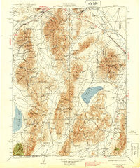
~ Sonoma Range NV topo map, 1:250000 scale, 1 X 1 Degree, Historical, 1939
Sonoma Range, Nevada, USGS topographic map dated 1939.
Includes geographic coordinates (latitude and longitude). This topographic map is suitable for hiking, camping, and exploring, or framing it as a wall map.
Printed on-demand using high resolution imagery, on heavy weight and acid free paper, or alternatively on a variety of synthetic materials.
Topos available on paper, Waterproof, Poly, or Tyvek. Usually shipping rolled, unless combined with other folded maps in one order.
- Product Number: USGS-5618810
- Free digital map download (high-resolution, GeoPDF): Sonoma Range, Nevada (file size: 10 MB)
- Map Size: please refer to the dimensions of the GeoPDF map above
- Weight (paper map): ca. 55 grams
- Map Type: POD USGS Topographic Map
- Map Series: HTMC
- Map Verison: Historical
- Cell ID: 322083
- Scan ID: 320649
- Woodland Tint: Yes
- Survey Year: 1932
- Datum: NAD27
- Map Projection: Polyconic
- Map published by United States Geological Survey
- Map Language: English
- Scanner Resolution: 600 dpi
- Map Cell Name: Winnemucca W
- Grid size: 1 X 1 Degree
- Date on map: 1939
- Map Scale: 1:250000
- Geographical region: Nevada, United States
Neighboring Maps:
All neighboring USGS topo maps are available for sale online at a variety of scales.
Spatial coverage:
Topo map Sonoma Range, Nevada, covers the geographical area associated the following places:
- Raglan - Piute - Bannock - Old Battle Mountain (historical) - Bonnie Briar (historical) - Golconda - Dewitt Mill - Cherry Creek (historical) - Winnemucca - Bailey (historical) - McCoy - Jersey (historical) - Galena (historical) - Blanco (historical) - Kyle Hot Springs - Preble - Stone House (historical) - Iron Point (historical) - Buckingham Camp - Knight - Rose Creek - Herrin - Fairview (historical) - Dun Glen (historical) - Red House - Gold Run (historical) - Telluride (historical) - Adelaide (historical) - Kennedy (historical) - Copper Basin - Ellison - Valmy
- Map Area ID: AREA4140-118-117
- Northwest corner Lat/Long code: USGSNW41-118
- Northeast corner Lat/Long code: USGSNE41-117
- Southwest corner Lat/Long code: USGSSW40-118
- Southeast corner Lat/Long code: USGSSE40-117
- Northern map edge Latitude: 41
- Southern map edge Latitude: 40
- Western map edge Longitude: -118
- Eastern map edge Longitude: -117


