
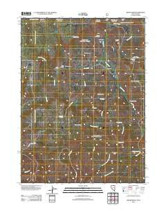
~ Winter Ridge NV topo map, 1:24000 scale, 7.5 X 7.5 Minute, Historical, 2012
Winter Ridge, Nevada, USGS topographic map dated 2012.
Includes geographic coordinates (latitude and longitude). This topographic map is suitable for hiking, camping, and exploring, or framing it as a wall map.
Printed on-demand using high resolution imagery, on heavy weight and acid free paper, or alternatively on a variety of synthetic materials.
Topos available on paper, Waterproof, Poly, or Tyvek. Usually shipping rolled, unless combined with other folded maps in one order.
- Product Number: USGS-5602024
- Free digital map download (high-resolution, GeoPDF): Winter Ridge, Nevada (file size: 17 MB)
- Map Size: please refer to the dimensions of the GeoPDF map above
- Weight (paper map): ca. 55 grams
- Map Type: POD USGS Topographic Map
- Map Series: US Topo
- Map Verison: Historical
- Cell ID: 49549
- Datum: North American Datum of 1983
- Map Projection: Transverse Mercator
- Map Cell Name: Winter Ridge
- Grid size: 7.5 X 7.5 Minute
- Date on map: 2012
- Map Scale: 1:24000
- Geographical region: Nevada, United States
Neighboring Maps:
All neighboring USGS topo maps are available for sale online at a variety of scales.
Spatial coverage:
Topo map Winter Ridge, Nevada, covers the geographical area associated the following places:
- Winter Ridge - Salmon Creek - Mustang Draw - Blizzard Bluff - Black Canyon - Deadhorse Point - State Line Meadows - Sagehen Creek - Little Salmon Creek - Merritt Creek - Bruneau Spring - Walker Creek - Ramsey Draw - Black Canyon Creek - Willis Creek - Assessor Draw - Horse Heaven Flat - Porcupine Creek - Deer Gulch - Rain Creek - Log Creek - Iron Mountain - Gedney Spring - Willis Meadow - Iron Spring - Nip and Tuck Draw - Pin Mountain - Moonshine Spring - Happy Home Place - Kunz Ranch - Yankee Bill Gulch - Boulder Basin - Whisky Point - Little Log Creek
- Map Area ID: AREA4241.875-116-115.875
- Northwest corner Lat/Long code: USGSNW42-116
- Northeast corner Lat/Long code: USGSNE42-115.875
- Southwest corner Lat/Long code: USGSSW41.875-116
- Southeast corner Lat/Long code: USGSSE41.875-115.875
- Northern map edge Latitude: 42
- Southern map edge Latitude: 41.875
- Western map edge Longitude: -116
- Eastern map edge Longitude: -115.875


