
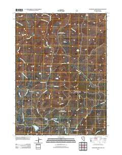
~ Tennessee Mountain NV topo map, 1:24000 scale, 7.5 X 7.5 Minute, Historical, 2012
Tennessee Mountain, Nevada, USGS topographic map dated 2012.
Includes geographic coordinates (latitude and longitude). This topographic map is suitable for hiking, camping, and exploring, or framing it as a wall map.
Printed on-demand using high resolution imagery, on heavy weight and acid free paper, or alternatively on a variety of synthetic materials.
Topos available on paper, Waterproof, Poly, or Tyvek. Usually shipping rolled, unless combined with other folded maps in one order.
- Product Number: USGS-5602020
- Free digital map download (high-resolution, GeoPDF): Tennessee Mountain, Nevada (file size: 16 MB)
- Map Size: please refer to the dimensions of the GeoPDF map above
- Weight (paper map): ca. 55 grams
- Map Type: POD USGS Topographic Map
- Map Series: US Topo
- Map Verison: Historical
- Cell ID: 44570
- Datum: North American Datum of 1983
- Map Projection: Transverse Mercator
- Map Cell Name: Tennessee Mountain
- Grid size: 7.5 X 7.5 Minute
- Date on map: 2012
- Map Scale: 1:24000
- Geographical region: Nevada, United States
Neighboring Maps:
All neighboring USGS topo maps are available for sale online at a variety of scales.
Spatial coverage:
Topo map Tennessee Mountain, Nevada, covers the geographical area associated the following places:
- Tennessee Spring - Big Bend Campground - Slate Creek - Tennessee Mountain - Parks Cabin - Burnt Timber Creek - Gold Creek Ranger Station - Diamond Jim Mine - Sand Creek - Martin Canyon - Sunflower Dam - Indian Johnnie Creek - Sunflower Reservoir - Mill Creek - McMahan Ranch - Keas Canyon - Waterlog Summit - Bieroth Slide - Telephone Creek - Tennessee Creek - Hicks Summit - The Mahoganies - Little Telephone Creek - Bieroth Spring - Lime Creek - Tennell Creek - Taylor Creek - Alder Mining District - Rosebud Mountain - Big Coffeepot Spring - Wildhorse Mine - Tennessee Gulch - Meadow Creek School (historical) - Bristol Spring - Keas Peak - Moonshine Gulch
- Map Area ID: AREA41.87541.75-115.75-115.625
- Northwest corner Lat/Long code: USGSNW41.875-115.75
- Northeast corner Lat/Long code: USGSNE41.875-115.625
- Southwest corner Lat/Long code: USGSSW41.75-115.75
- Southeast corner Lat/Long code: USGSSE41.75-115.625
- Northern map edge Latitude: 41.875
- Southern map edge Latitude: 41.75
- Western map edge Longitude: -115.75
- Eastern map edge Longitude: -115.625


