
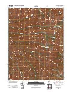
~ Ruby Dome NV topo map, 1:24000 scale, 7.5 X 7.5 Minute, Historical, 2012
Ruby Dome, Nevada, USGS topographic map dated 2012.
Includes geographic coordinates (latitude and longitude). This topographic map is suitable for hiking, camping, and exploring, or framing it as a wall map.
Printed on-demand using high resolution imagery, on heavy weight and acid free paper, or alternatively on a variety of synthetic materials.
Topos available on paper, Waterproof, Poly, or Tyvek. Usually shipping rolled, unless combined with other folded maps in one order.
- Product Number: USGS-5587394
- Free digital map download (high-resolution, GeoPDF): Ruby Dome, Nevada (file size: 21 MB)
- Map Size: please refer to the dimensions of the GeoPDF map above
- Weight (paper map): ca. 55 grams
- Map Type: POD USGS Topographic Map
- Map Series: US Topo
- Map Verison: Historical
- Cell ID: 38871
- Datum: North American Datum of 1983
- Map Projection: Transverse Mercator
- Map Cell Name: Ruby Dome
- Grid size: 7.5 X 7.5 Minute
- Date on map: 2012
- Map Scale: 1:24000
- Geographical region: Nevada, United States
Neighboring Maps:
All neighboring USGS topo maps are available for sale online at a variety of scales.
Spatial coverage:
Topo map Ruby Dome, Nevada, covers the geographical area associated the following places:
- Mount Silliman - Segunda Creek - Mount Fitzgerald - Roads End Picnicking Site - American Beauty Mine - Michigan Mine - Ruby Crest National Recreation Trail Head - Battle Creek Mines - Ruby Dome - Goat Lake - Wines Peak - Drown Peak - Dollar Lakes - Hargrove Mine - Favre Lake - Ruby Valley Mining District - Ruby Mountains Scenic Area (historical) - Lake Peak - Mount Gilbert - Island Lake - Ruby Mountains Wilderness - Echo Lake - Ruby Mountain Ranger District - Snow Lake Peak - North Furlong Lake - Castle Lake - Mahogany Creek - Lamoille Lake - Liberty Lake - Liberty Pass
- Map Area ID: AREA40.62540.5-115.5-115.375
- Northwest corner Lat/Long code: USGSNW40.625-115.5
- Northeast corner Lat/Long code: USGSNE40.625-115.375
- Southwest corner Lat/Long code: USGSSW40.5-115.5
- Southeast corner Lat/Long code: USGSSE40.5-115.375
- Northern map edge Latitude: 40.625
- Southern map edge Latitude: 40.5
- Western map edge Longitude: -115.5
- Eastern map edge Longitude: -115.375


