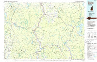
~ Groveton NH topo map, 1:100000 scale, 30 X 60 Minute, Historical, 1986, updated 1986
Groveton, New Hampshire, USGS topographic map dated 1986.
Includes geographic coordinates (latitude and longitude). This topographic map is suitable for hiking, camping, and exploring, or framing it as a wall map.
Printed on-demand using high resolution imagery, on heavy weight and acid free paper, or alternatively on a variety of synthetic materials.
Topos available on paper, Waterproof, Poly, or Tyvek. Usually shipping rolled, unless combined with other folded maps in one order.
- Product Number: USGS-5583970
- Free digital map download (high-resolution, GeoPDF): Groveton, New Hampshire (file size: 19 MB)
- Map Size: please refer to the dimensions of the GeoPDF map above
- Weight (paper map): ca. 55 grams
- Map Type: POD USGS Topographic Map
- Map Series: HTMC
- Map Verison: Historical
- Cell ID: 67616
- Scan ID: 330403
- Imprint Year: 1986
- Woodland Tint: Yes
- Aerial Photo Year: 1977
- Edit Year: 1986
- Datum: NAD27
- Map Projection: Universal Transverse Mercator
- Planimetric: Yes
- Map published by United States Geological Survey
- Map Language: English
- Scanner Resolution: 600 dpi
- Map Cell Name: Groveton
- Grid size: 30 X 60 Minute
- Date on map: 1986
- Map Scale: 1:100000
- Geographical region: New Hampshire, United States
Neighboring Maps:
All neighboring USGS topo maps are available for sale online at a variety of scales.
Spatial coverage:
Topo map Groveton, New Hampshire, covers the geographical area associated the following places:
- Lennington - Georges - Island Pond - Canaan - Wentworth Location - Coos Junction - Arlins - West Stewartstown - East Charleston - Egypt - North Kirby - Wenlock - East Haven - Meriden Hill - Burke Hollow - Tinkerville - Cones - Damon Crossing - Crystal - Errol - Stark - Colebrook - East Lyndon - Columbia - Dummer - East Burke - Columbia - Stevens - Granby - Hartwellville - Maidstone - Paris (historical) - North Stratford - Lost Nation - Upton - Gallup Mills - Groveton - Averill - Milan - Dixville Notch - Bullthroat - Copperville - West Milan - Stratford - Northumberland - Browns Mill - Stewartstown Hollow - East Brighton - Bloomfield - Masons - Wilsons Mills - Guildhall - The Hand - Beatties - Simms Hill - Morgan Center - Moccasin Mill - Upper Kidderville - Lost Nation - Mapleton - Folsom - Bungy - Newark Hollow - Victory - Kidderville - Percy - West Burke - Brunswick Springs
- Map Area ID: AREA4544.5-72-71
- Northwest corner Lat/Long code: USGSNW45-72
- Northeast corner Lat/Long code: USGSNE45-71
- Southwest corner Lat/Long code: USGSSW44.5-72
- Southeast corner Lat/Long code: USGSSE44.5-71
- Northern map edge Latitude: 45
- Southern map edge Latitude: 44.5
- Western map edge Longitude: -72
- Eastern map edge Longitude: -71