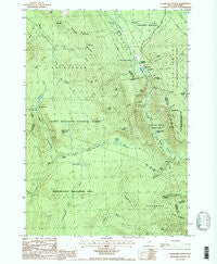
~ Crawford Notch NH topo map, 1:24000 scale, 7.5 X 7.5 Minute, Historical, 1987, updated 1987
Crawford Notch, New Hampshire, USGS topographic map dated 1987.
Includes geographic coordinates (latitude and longitude). This topographic map is suitable for hiking, camping, and exploring, or framing it as a wall map.
Printed on-demand using high resolution imagery, on heavy weight and acid free paper, or alternatively on a variety of synthetic materials.
Topos available on paper, Waterproof, Poly, or Tyvek. Usually shipping rolled, unless combined with other folded maps in one order.
- Product Number: USGS-5582334
- Free digital map download (high-resolution, GeoPDF): Crawford Notch, New Hampshire (file size: 15 MB)
- Map Size: please refer to the dimensions of the GeoPDF map above
- Weight (paper map): ca. 55 grams
- Map Type: POD USGS Topographic Map
- Map Series: HTMC
- Map Verison: Historical
- Cell ID: 10627
- Scan ID: 329515
- Imprint Year: 1987
- Woodland Tint: Yes
- Aerial Photo Year: 1981
- Edit Year: 1987
- Field Check Year: 1983
- Datum: NAD27
- Map Projection: Transverse Mercator
- Provisional map: Yes
- Map published by United States Geological Survey
- Map Language: English
- Scanner Resolution: 600 dpi
- Map Cell Name: Crawford Notch
- Grid size: 7.5 X 7.5 Minute
- Date on map: 1987
- Map Scale: 1:24000
- Geographical region: New Hampshire, United States
Neighboring Maps:
All neighboring USGS topo maps are available for sale online at a variety of scales.
Spatial coverage:
Topo map Crawford Notch, New Hampshire, covers the geographical area associated the following places:
- Hale Brook - Mount Field Brook - Shoal Pond Trail - Willey Brook - Webster Cliff Trail - Elephant Head - Mount Rosebrook - Zealand Falls - Whitewall Mount - A-Z Trail - Willey House Camps - Zealand Valley Trail - White Mountain National Forest - Mount Avalon Trail - Mount Willard - Crawford House - Mount Willey - Flume Cascade - Lincoln Woods Scenic Area - Arethusa Falls - Gibbs Brook Scenic Area - Gibbs Brook - Ethan Pond Trail - Mount Tom Brook - Jumping Brook - Rosebrook Mountains - Wiley Range Trail - Beans Grant - Mount Rosebrook Trail - Webster Brook - Mount Avalon - Crawford Notch State Reservation - Silver Cascade - Elephant Head Brook - Stillwater By-Pass - Zealand Pond - Shoal Pond - Zealand Notch - Ethan Pond - Mount Stickney - Whitewall Brook - Mount Field - Avalanche Brook - Kedron Brook - Ammonoosuc Lake - Mount Webster - Willey House - Zealand Trail - Ripley Falls - Webster Trail - Zeacliff Trail - Avalon Trail - Mount Webster Trail - Mount Tom - Havie Brook - Thoreau Falls - Tisdale Spring - Thoreau Falls Trail - Mount Echo - Ethan Pond Shelter - Mount Bemis - Saco Lake
- Map Area ID: AREA44.2544.125-71.5-71.375
- Northwest corner Lat/Long code: USGSNW44.25-71.5
- Northeast corner Lat/Long code: USGSNE44.25-71.375
- Southwest corner Lat/Long code: USGSSW44.125-71.5
- Southeast corner Lat/Long code: USGSSE44.125-71.375
- Northern map edge Latitude: 44.25
- Southern map edge Latitude: 44.125
- Western map edge Longitude: -71.5
- Eastern map edge Longitude: -71.375