
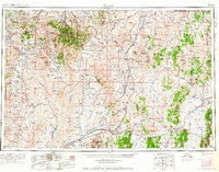
~ Wells NV topo map, 1:250000 scale, 1 X 2 Degree, Historical, 1961, updated 1961
Wells, Nevada, USGS topographic map dated 1961.
Includes geographic coordinates (latitude and longitude). This topographic map is suitable for hiking, camping, and exploring, or framing it as a wall map.
Printed on-demand using high resolution imagery, on heavy weight and acid free paper, or alternatively on a variety of synthetic materials.
Topos available on paper, Waterproof, Poly, or Tyvek. Usually shipping rolled, unless combined with other folded maps in one order.
- Product Number: USGS-5573898
- Free digital map download (high-resolution, GeoPDF): Wells, Nevada (file size: 22 MB)
- Map Size: please refer to the dimensions of the GeoPDF map above
- Weight (paper map): ca. 55 grams
- Map Type: POD USGS Topographic Map
- Map Series: HTMC
- Map Verison: Historical
- Cell ID: 69092
- Scan ID: 321801
- Imprint Year: 1961
- Woodland Tint: Yes
- Aerial Photo Year: 1954
- Edit Year: 1970
- Field Check Year: 1955
- Datum: Unstated
- Map Projection: Transverse Mercator
- Map published by United States Geological Survey
- Map Language: English
- Scanner Resolution: 600 dpi
- Map Cell Name: Wells
- Grid size: 1 X 2 Degree
- Date on map: 1961
- Map Scale: 1:250000
- Geographical region: Nevada, United States
Neighboring Maps:
All neighboring USGS topo maps are available for sale online at a variety of scales.
Spatial coverage:
Topo map Wells, Nevada, covers the geographical area associated the following places:
- Island Mountain (historical) - Jackpot - Schoer Place - Rock House - Oasis - Cobre - Pequop - San Jacinto - Pavlak (historical) - Mountain City - Williams Cabin - Bruno City (historical) - Tulasco - Bayard (historical) - Point of Rocks - Deeth - Buell (historical) - Welcome - Dinner Station - Riverside (historical) - Bauvard (historical) - Wells - Toano (historical) - Holborn - Rowland - Riverside Park (historical) - Alazon - Contact - Shores - Tecoma - Moor - O'Neil (historical) - Jack Creek Camp - Loray - Bueasta (historical) - Fenelon - Wilkins - Morlan (historical) - Beaver (historical) - Melandco - North Fork - Jarbidge - Patsville - Afton (historical) - Morton (historical) - Delano (historical) - Henry - Delaplain - Charleston - Montello
- Map Area ID: AREA4241-116-114
- Northwest corner Lat/Long code: USGSNW42-116
- Northeast corner Lat/Long code: USGSNE42-114
- Southwest corner Lat/Long code: USGSSW41-116
- Southeast corner Lat/Long code: USGSSE41-114
- Northern map edge Latitude: 42
- Southern map edge Latitude: 41
- Western map edge Longitude: -116
- Eastern map edge Longitude: -114


