
~ Timber Mountain NV topo map, 1:62500 scale, 15 X 15 Minute, Historical, 1952, updated 1980
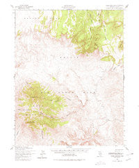
Timber Mountain, Nevada, USGS topographic map dated 1952.
Includes geographic coordinates (latitude and longitude). This topographic map is suitable for hiking, camping, and exploring, or framing it as a wall map.
Printed on-demand using high resolution imagery, on heavy weight and acid free paper, or alternatively on a variety of synthetic materials.
Topos available on paper, Waterproof, Poly, or Tyvek. Usually shipping rolled, unless combined with other folded maps in one order.
- Product Number: USGS-5573272
- Free digital map download (high-resolution, GeoPDF): Timber Mountain, Nevada (file size: 9 MB)
- Map Size: please refer to the dimensions of the GeoPDF map above
- Weight (paper map): ca. 55 grams
- Map Type: POD USGS Topographic Map
- Map Series: HTMC
- Map Verison: Historical
- Cell ID: 63573
- Scan ID: 321362
- Imprint Year: 1980
- Woodland Tint: Yes
- Aerial Photo Year: 1952
- Field Check Year: 1952
- Datum: NAD27
- Map Projection: Polyconic
- Map published by United States Geological Survey
- Map published by United States Army Corps of Engineers
- Map published by United States Army
- Map Language: English
- Scanner Resolution: 600 dpi
- Map Cell Name: Timber Mountain
- Grid size: 15 X 15 Minute
- Date on map: 1952
- Map Scale: 1:62500
- Geographical region: Nevada, United States
Neighboring Maps:
All neighboring USGS topo maps are available for sale online at a variety of scales.
Spatial coverage:
Topo map Timber Mountain, Nevada, covers the geographical area associated the following places:
- East Cat Canyon - Nevada Test Site Area 18 - Stockade Wash - Nevada Test Site Area 30 - Buckboard Mesa - Falcon Canyon - Pahute Mesa Airstrip - Split Ridge - Blacktop Buttes - Landmark Rock - Rattlesnake Ridge - Timber Mountain - Forty Mile State Park (historical) - Ammonia Tanks - Scrugham Peak - South Timber Peak - North Timber Peak - Brushy Canyon - Piapi Canyon - Big Burn Valley - Picture Rock
- Map Area ID: AREA37.2537-116.5-116.25
- Northwest corner Lat/Long code: USGSNW37.25-116.5
- Northeast corner Lat/Long code: USGSNE37.25-116.25
- Southwest corner Lat/Long code: USGSSW37-116.5
- Southeast corner Lat/Long code: USGSSE37-116.25
- Northern map edge Latitude: 37.25
- Southern map edge Latitude: 37
- Western map edge Longitude: -116.5
- Eastern map edge Longitude: -116.25


