
~ Railroad Point NV topo map, 1:62500 scale, 15 X 15 Minute, Historical, 1965, updated 1967
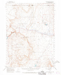
Railroad Point, Nevada, USGS topographic map dated 1965.
Includes geographic coordinates (latitude and longitude). This topographic map is suitable for hiking, camping, and exploring, or framing it as a wall map.
Printed on-demand using high resolution imagery, on heavy weight and acid free paper, or alternatively on a variety of synthetic materials.
Topos available on paper, Waterproof, Poly, or Tyvek. Usually shipping rolled, unless combined with other folded maps in one order.
- Product Number: USGS-5573046
- Free digital map download (high-resolution, GeoPDF): Railroad Point, Nevada (file size: 6 MB)
- Map Size: please refer to the dimensions of the GeoPDF map above
- Weight (paper map): ca. 55 grams
- Map Type: POD USGS Topographic Map
- Map Series: HTMC
- Map Verison: Historical
- Cell ID: 61423
- Scan ID: 321218
- Imprint Year: 1967
- Aerial Photo Year: 1963
- Field Check Year: 1965
- Datum: NAD27
- Map Projection: Polyconic
- Map published by United States Geological Survey
- Map Language: English
- Scanner Resolution: 600 dpi
- Map Cell Name: Railroad Point
- Grid size: 15 X 15 Minute
- Date on map: 1965
- Map Scale: 1:62500
- Geographical region: Nevada, United States
Neighboring Maps:
All neighboring USGS topo maps are available for sale online at a variety of scales.
Spatial coverage:
Topo map Railroad Point, Nevada, covers the geographical area associated the following places:
- Bog Hot Reservoir - McGhee Mountain - Thousand Creek Gorge - Virgin Creek - McGee Grade - Bog Hot Well - Thousand Creek Dam - Warm Springs - Oregon Canyon - Cold Spring - Rincon Creek - Bog Hot Well - Three Springs - Bog Hot Reservoir Dam - Jackass Flat - Giliotti Well - McGhee Mountain Spring - Painted Hills Mine - Bog Hot Ranch - Gridley Lake - Thousand Creek Ranch - Bog Hot Springs - Dufurrena Grade - Long Draw - Twin Peak - Burro Spring - Warm Springs - Railroad Point - Alder Creek Ranch
- Map Area ID: AREA4241.75-119-118.75
- Northwest corner Lat/Long code: USGSNW42-119
- Northeast corner Lat/Long code: USGSNE42-118.75
- Southwest corner Lat/Long code: USGSSW41.75-119
- Southeast corner Lat/Long code: USGSSE41.75-118.75
- Northern map edge Latitude: 42
- Southern map edge Latitude: 41.75
- Western map edge Longitude: -119
- Eastern map edge Longitude: -118.75


