
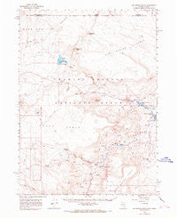
~ Big Spring Butte NV topo map, 1:62500 scale, 15 X 15 Minute, Historical, 1966, updated 1968
Big Spring Butte, Nevada, USGS topographic map dated 1966.
Includes geographic coordinates (latitude and longitude). This topographic map is suitable for hiking, camping, and exploring, or framing it as a wall map.
Printed on-demand using high resolution imagery, on heavy weight and acid free paper, or alternatively on a variety of synthetic materials.
Topos available on paper, Waterproof, Poly, or Tyvek. Usually shipping rolled, unless combined with other folded maps in one order.
- Product Number: USGS-5572180
- Free digital map download (high-resolution, GeoPDF): Big Spring Butte, Nevada (file size: 6 MB)
- Map Size: please refer to the dimensions of the GeoPDF map above
- Weight (paper map): ca. 55 grams
- Map Type: POD USGS Topographic Map
- Map Series: HTMC
- Map Verison: Historical
- Cell ID: 51380
- Scan ID: 320718
- Imprint Year: 1968
- Aerial Photo Year: 1963
- Field Check Year: 1966
- Datum: NAD27
- Map Projection: Polyconic
- Map published by United States Geological Survey
- Map Language: English
- Scanner Resolution: 600 dpi
- Map Cell Name: Big Spring Butte
- Grid size: 15 X 15 Minute
- Date on map: 1966
- Map Scale: 1:62500
- Geographical region: Nevada, United States
Neighboring Maps:
All neighboring USGS topo maps are available for sale online at a variety of scales.
Spatial coverage:
Topo map Big Spring Butte, Nevada, covers the geographical area associated the following places:
- Gooch Table - Dufurrena Pond Number 19 Dam - Lower Jacobs Water Hole - Big Spring - Warm Spring - Hazeltine Lake - Pup Lake - Flat Top Butte - Sage Hen Reservoir - Upper Jacobs Water Hole - Thousand Creek Spring - Royal Peacock Mine - Virgin Valley Reservoir - Big Spring Creek - Dufurrena Pond Number Twenty - Hawksy Walksy - Middle Jacobs Water Hole - Sheldon National Wildlife Refuge - McKenney Camp - Dufurrena Ranch - Virgin Valley Reservoir Dam - Hawksy Walksy - Virgin Valley - Virgin Valley Mining District - Dufurrena Pond Number Twenty-One - Big Spring Table - The Knob Reservoir - Mud Spring Canyon - Dufurrena Pond Number Nineteen - Dufurrena Pond Number 22 - Perlite Reservoir - Dufurrena Pond Number 20 Dam - Big Spring Butte - Virgin Valley Campground - Big Spring Reservoir Dam - Rhyolite Spring - Sagebrush Creek - Big Spring Reservoir - Center Reservoir - Jacobs Waterhole - Bog Spring - Boundary Butte - Dam Number 10 Dam - Sheep Pen Reservoir - Buck Lake - Esling Ranch - Rainbow Ridge Mine - Virgin Valley Ranch - Dufurrena Ranch Headquarters - Pond Number Thirteen - Gooch Lake - Brushy Point - Echo Canyon - Virgin Mine
- Map Area ID: AREA4241.75-119.25-119
- Northwest corner Lat/Long code: USGSNW42-119.25
- Northeast corner Lat/Long code: USGSNE42-119
- Southwest corner Lat/Long code: USGSSW41.75-119.25
- Southeast corner Lat/Long code: USGSSE41.75-119
- Northern map edge Latitude: 42
- Southern map edge Latitude: 41.75
- Western map edge Longitude: -119.25
- Eastern map edge Longitude: -119


