
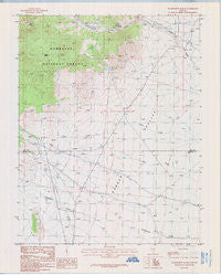
~ Wadsworth Ranch NV topo map, 1:24000 scale, 7.5 X 7.5 Minute, Historical, 1985, updated 1986
Wadsworth Ranch, Nevada, USGS topographic map dated 1985.
Includes geographic coordinates (latitude and longitude). This topographic map is suitable for hiking, camping, and exploring, or framing it as a wall map.
Printed on-demand using high resolution imagery, on heavy weight and acid free paper, or alternatively on a variety of synthetic materials.
Topos available on paper, Waterproof, Poly, or Tyvek. Usually shipping rolled, unless combined with other folded maps in one order.
- Product Number: USGS-5571724
- Free digital map download (high-resolution, GeoPDF): Wadsworth Ranch, Nevada (file size: 7 MB)
- Map Size: please refer to the dimensions of the GeoPDF map above
- Weight (paper map): ca. 55 grams
- Map Type: POD USGS Topographic Map
- Map Series: HTMC
- Map Verison: Historical
- Cell ID: 47114
- Scan ID: 519312
- Imprint Year: 1986
- Woodland Tint: Yes
- Aerial Photo Year: 1980
- Edit Year: 1985
- Field Check Year: 1981
- Datum: NAD27
- Map Projection: Transverse Mercator
- Provisional map: Yes
- Map published by United States Geological Survey
- Map Language: English
- Scanner Resolution: 508 dpi
- Map Cell Name: Wadsworth Ranch
- Grid size: 7.5 X 7.5 Minute
- Date on map: 1985
- Map Scale: 1:24000
- Geographical region: Nevada, United States
Neighboring Maps:
All neighboring USGS topo maps are available for sale online at a variety of scales.
Spatial coverage:
Topo map Wadsworth Ranch, Nevada, covers the geographical area associated the following places:
- Walch Ranch - Carpenter Spring - Carpenter Pipe Line (historical) - Pine Creek Spring - Black Spring - Cherry Canyon - Mystery Mountain - Uhalde Ranch - Battaman Spring - Modes Hole Spring - Wadsworth Ranch - Iron Cap Mine - Garden Valley Reservoir Number 1
- Map Area ID: AREA38.12538-115.625-115.5
- Northwest corner Lat/Long code: USGSNW38.125-115.625
- Northeast corner Lat/Long code: USGSNE38.125-115.5
- Southwest corner Lat/Long code: USGSSW38-115.625
- Southeast corner Lat/Long code: USGSSE38-115.5
- Northern map edge Latitude: 38.125
- Southern map edge Latitude: 38
- Western map edge Longitude: -115.625
- Eastern map edge Longitude: -115.5


