
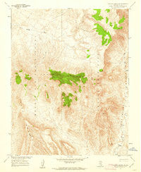
~ Topopah Spring NW NV topo map, 1:24000 scale, 7.5 X 7.5 Minute, Historical, 1961, updated 1962
Topopah Spring NW, Nevada, USGS topographic map dated 1961.
Includes geographic coordinates (latitude and longitude). This topographic map is suitable for hiking, camping, and exploring, or framing it as a wall map.
Printed on-demand using high resolution imagery, on heavy weight and acid free paper, or alternatively on a variety of synthetic materials.
Topos available on paper, Waterproof, Poly, or Tyvek. Usually shipping rolled, unless combined with other folded maps in one order.
- Product Number: USGS-5571506
- Free digital map download (high-resolution, GeoPDF): Topopah Spring NW, Nevada (file size: 16 MB)
- Map Size: please refer to the dimensions of the GeoPDF map above
- Weight (paper map): ca. 55 grams
- Map Type: POD USGS Topographic Map
- Map Series: HTMC
- Map Verison: Historical
- Cell ID: 45429
- Scan ID: 320358
- Imprint Year: 1962
- Woodland Tint: Yes
- Aerial Photo Year: 1959
- Field Check Year: 1961
- Datum: NAD27
- Map Projection: Polyconic
- Map published by United States Geological Survey
- Map Language: English
- Scanner Resolution: 600 dpi
- Map Cell Name: Topopah Spring NW
- Grid size: 7.5 X 7.5 Minute
- Date on map: 1961
- Map Scale: 1:24000
- Geographical region: Nevada, United States
Neighboring Maps:
All neighboring USGS topo maps are available for sale online at a variety of scales.
Spatial coverage:
Topo map Topopah Spring NW, Nevada, covers the geographical area associated the following places:
- West Ridge - Comb Peak - Claim Canyon - Delirium Canyon - Joey Ridge - Isolation Ridge - The Prow - Yucca Mountain - Pinyon Pass - Pinnacles Ridge - Paintbrush Canyon - Castellated Ridge - Prow Pass - Castle Point - Jake Ridge - Pah Canyon - Three Forks Wash - Chocolate Mountain - Vent Pass - Dome Mountain - Black Glass Canyon - Jet Ridge - Boundary Butte
- Map Area ID: AREA3736.875-116.5-116.375
- Northwest corner Lat/Long code: USGSNW37-116.5
- Northeast corner Lat/Long code: USGSNE37-116.375
- Southwest corner Lat/Long code: USGSSW36.875-116.5
- Southeast corner Lat/Long code: USGSSE36.875-116.375
- Northern map edge Latitude: 37
- Southern map edge Latitude: 36.875
- Western map edge Longitude: -116.5
- Eastern map edge Longitude: -116.375


