
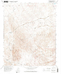
~ Spirit Mtn NV topo map, 1:24000 scale, 7.5 X 7.5 Minute, Historical, 1959, updated 1976
Spirit Mtn, Nevada, USGS topographic map dated 1959.
Includes geographic coordinates (latitude and longitude). This topographic map is suitable for hiking, camping, and exploring, or framing it as a wall map.
Printed on-demand using high resolution imagery, on heavy weight and acid free paper, or alternatively on a variety of synthetic materials.
Topos available on paper, Waterproof, Poly, or Tyvek. Usually shipping rolled, unless combined with other folded maps in one order.
- Product Number: USGS-5571076
- Free digital map download (high-resolution, GeoPDF): Spirit Mtn, Nevada (file size: 13 MB)
- Map Size: please refer to the dimensions of the GeoPDF map above
- Weight (paper map): ca. 55 grams
- Map Type: POD USGS Topographic Map
- Map Series: HTMC
- Map Verison: Historical
- Cell ID: 71683
- Scan ID: 320141
- Imprint Year: 1976
- Visual Version Number: 1
- Aerial Photo Year: 1954
- Field Check Year: 1959
- Datum: NAD27
- Map Projection: Polyconic
- Map published by United States Geological Survey
- Map Language: English
- Scanner Resolution: 600 dpi
- Map Cell Name: Spirit Mountain
- Grid size: 7.5 X 7.5 Minute
- Date on map: 1959
- Map Scale: 1:24000
- Geographical region: Nevada, United States
Neighboring Maps:
All neighboring USGS topo maps are available for sale online at a variety of scales.
Spatial coverage:
Topo map Spirit Mtn, Nevada, covers the geographical area associated the following places:
- Roman Mine - Willow Spring - Camp Thurman - Jackdaw Group Mine - Pipe Spring - Empire (historical) - Mount Newberry - Goldenrod Mine - Roman Spring - Newberry Mining District - Yellow Stone Mine - Christmas Tree Pass - White Rock Mine - Spirit Mountain Wilderness - Potential Mine - Devils Thumb - Roman Wash - Spirit Mountain - North Peak - Discovery Spring - Empire Mine
- Map Area ID: AREA35.37535.25-114.75-114.625
- Northwest corner Lat/Long code: USGSNW35.375-114.75
- Northeast corner Lat/Long code: USGSNE35.375-114.625
- Southwest corner Lat/Long code: USGSSW35.25-114.75
- Southeast corner Lat/Long code: USGSSE35.25-114.625
- Northern map edge Latitude: 35.375
- Southern map edge Latitude: 35.25
- Western map edge Longitude: -114.75
- Eastern map edge Longitude: -114.625


