
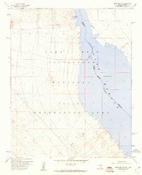
~ Spirit Mtn NW NV topo map, 1:24000 scale, 7.5 X 7.5 Minute, Historical, 1959, updated 1960
Spirit Mtn NW, Nevada, USGS topographic map dated 1959.
Includes geographic coordinates (latitude and longitude). This topographic map is suitable for hiking, camping, and exploring, or framing it as a wall map.
Printed on-demand using high resolution imagery, on heavy weight and acid free paper, or alternatively on a variety of synthetic materials.
Topos available on paper, Waterproof, Poly, or Tyvek. Usually shipping rolled, unless combined with other folded maps in one order.
- Product Number: USGS-5571072
- Free digital map download (high-resolution, GeoPDF): Spirit Mtn NW, Nevada (file size: 7 MB)
- Map Size: please refer to the dimensions of the GeoPDF map above
- Weight (paper map): ca. 55 grams
- Map Type: POD USGS Topographic Map
- Map Series: HTMC
- Map Verison: Historical
- Cell ID: 42516
- Scan ID: 320145
- Imprint Year: 1960
- Aerial Photo Year: 1954
- Field Check Year: 1959
- Datum: NAD27
- Map Projection: Polyconic
- Map published by United States Geological Survey
- Map Language: English
- Scanner Resolution: 600 dpi
- Map Cell Name: Spirit Mountain NW
- Grid size: 7.5 X 7.5 Minute
- Date on map: 1959
- Map Scale: 1:24000
- Geographical region: Nevada, United States
Neighboring Maps:
All neighboring USGS topo maps are available for sale online at a variety of scales.
Spatial coverage:
Topo map Spirit Mtn NW, Nevada, covers the geographical area associated the following places:
- Cottonwood Valley Cove - Cottontail Cove - Ski Cove - Five Rapids (historical) - Six Mile Area - Cottonwood Cove - Windmill Cove - D Hutton Ranch (historical) - Nellis Wash - Cottonwood Cove Rural Branch Post Office - Nine Mile Coves - Cottonwood Valley - Airport Cove - Gremlin Cove - Nellis Cove - Sandy Point Cove - Finger Cove - Mesquite Cove - Water Wheel Cove - Bill Gayes Cove - Pot Cove - Riverside Ranch (historical) - Cottonwood East Area - Six Mile Cove - Cottonwood Landing Field (historical) - Tequila Cove - Three Sisters Cove - Box Cove - Carp Cove - Cottonwood Camp (historical) - North Basin Light Cove - Mesa Cove - Dead Cove - Quartette (historical) - Cottonwood Cove - Cottonwood Island (historical) - Nellis Wash Wilderness - Searchlight Ferry - Cottonwood Island Cove - Levi Cove - Hog Farm Cove - Lost Cove - Lake Mohave
- Map Area ID: AREA35.535.375-114.75-114.625
- Northwest corner Lat/Long code: USGSNW35.5-114.75
- Northeast corner Lat/Long code: USGSNE35.5-114.625
- Southwest corner Lat/Long code: USGSSW35.375-114.75
- Southeast corner Lat/Long code: USGSSE35.375-114.625
- Northern map edge Latitude: 35.5
- Southern map edge Latitude: 35.375
- Western map edge Longitude: -114.75
- Eastern map edge Longitude: -114.625


