
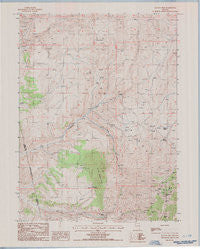
~ Ravens Nest NV topo map, 1:24000 scale, 7.5 X 7.5 Minute, Historical, 1985, updated 1986
Ravens Nest, Nevada, USGS topographic map dated 1985.
Includes geographic coordinates (latitude and longitude). This topographic map is suitable for hiking, camping, and exploring, or framing it as a wall map.
Printed on-demand using high resolution imagery, on heavy weight and acid free paper, or alternatively on a variety of synthetic materials.
Topos available on paper, Waterproof, Poly, or Tyvek. Usually shipping rolled, unless combined with other folded maps in one order.
- Product Number: USGS-5570504
- Free digital map download (high-resolution, GeoPDF): Ravens Nest, Nevada (file size: 10 MB)
- Map Size: please refer to the dimensions of the GeoPDF map above
- Weight (paper map): ca. 55 grams
- Map Type: POD USGS Topographic Map
- Map Series: HTMC
- Map Verison: Historical
- Cell ID: 37161
- Scan ID: 518730
- Imprint Year: 1986
- Woodland Tint: Yes
- Aerial Photo Year: 1982
- Edit Year: 1985
- Field Check Year: 1983
- Datum: NAD27
- Map Projection: Transverse Mercator
- Provisional map: Yes
- Map published by United States Geological Survey
- Map Language: English
- Scanner Resolution: 508 dpi
- Map Cell Name: Ravens Nest
- Grid size: 7.5 X 7.5 Minute
- Date on map: 1985
- Map Scale: 1:24000
- Geographical region: Nevada, United States
Neighboring Maps:
All neighboring USGS topo maps are available for sale online at a variety of scales.
Spatial coverage:
Topo map Ravens Nest, Nevada, covers the geographical area associated the following places:
- Red Springs - Grey Eagle Mine - Ennor Mine - Delmas Mine - Sweepstake Mine - Helen M Mine - Key Mine - Sky Blue Mine - Cherry Springs - Ravens Nest - Mill Creek Spring - Burke Mine - Webb Ranch - Pine Mountain - Stump Spring - Palisade Mine - Independence Mine - Mahogany Mine - Silver King Mine - Tripoli Mine - Sylvania Mine - Murdock Spring - Bullion Mine - Webfoot Mine - Brodine Mine - Bunker Hill - Standing Elk Mine - Red Bird Mine - Copper Bell Mine - Storm King Mine - Piñon Range - Webb Creek - Mendota Mine
- Map Area ID: AREA40.62540.5-116.125-116
- Northwest corner Lat/Long code: USGSNW40.625-116.125
- Northeast corner Lat/Long code: USGSNE40.625-116
- Southwest corner Lat/Long code: USGSSW40.5-116.125
- Southeast corner Lat/Long code: USGSSE40.5-116
- Northern map edge Latitude: 40.625
- Southern map edge Latitude: 40.5
- Western map edge Longitude: -116.125
- Eastern map edge Longitude: -116


