
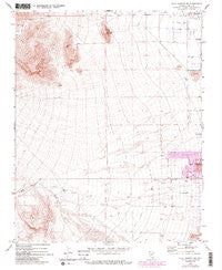
~ Blue Diamond NE NV topo map, 1:24000 scale, 7.5 X 7.5 Minute, Historical, 1972, updated 1984
Blue Diamond NE, Nevada, USGS topographic map dated 1972.
Includes geographic coordinates (latitude and longitude). This topographic map is suitable for hiking, camping, and exploring, or framing it as a wall map.
Printed on-demand using high resolution imagery, on heavy weight and acid free paper, or alternatively on a variety of synthetic materials.
Topos available on paper, Waterproof, Poly, or Tyvek. Usually shipping rolled, unless combined with other folded maps in one order.
- Product Number: USGS-5567030
- Free digital map download (high-resolution, GeoPDF): Blue Diamond NE, Nevada (file size: 11 MB)
- Map Size: please refer to the dimensions of the GeoPDF map above
- Weight (paper map): ca. 55 grams
- Map Type: POD USGS Topographic Map
- Map Series: HTMC
- Map Verison: Historical
- Cell ID: 4484
- Scan ID: 318159
- Imprint Year: 1984
- Aerial Photo Year: 1982
- Edit Year: 1983
- Field Check Year: 1972
- Datum: NAD27
- Map Projection: Transverse Mercator
- Map published by United States Geological Survey
- Map Language: English
- Scanner Resolution: 600 dpi
- Map Cell Name: Blue Diamond NE
- Grid size: 7.5 X 7.5 Minute
- Date on map: 1972
- Map Scale: 1:24000
- Geographical region: Nevada, United States
Neighboring Maps:
All neighboring USGS topo maps are available for sale online at a variety of scales.
Spatial coverage:
Topo map Blue Diamond NE, Nevada, covers the geographical area associated the following places:
- Shadow Hills Baptist Church - Sahara West Library and Fine Arts Museum - Trails Village Center Shopping Center - Childrens World Learning Center - Mountain View Lutheran Church - Angel Park Golf Club - KIinderCare Learning Centers - Mountain View Presbyterian Church - Lakeside Village Plaza - Grace in the Desert Episcopal Church - POE 695 Post Office - Clarence Piggott Elementary School - International Christian Academy - Las Vegas Fire and Rescue Station 47 - William R Lummis Elementary School - Red Rock Wash - Johnson Community School Park - Summerlin Evangelical Lutheran Church - Ruthe Deskin Elementary School - Lit'l Scholar Summerlin - Harvest Church of the Nazarene - University Medical Center of Southern Nevada Summerlin Area Quick Care - Tabernacle of Praise Church - Las Vegas Fire and Rescue Station 45 - Aloha Shores Park - Pueblo Park - Tournament Players Club at the Canyons Golf Course - Unity Church of the Desert - Milton I Schwartz Hebrew Academy - Victory Vegas Church - KKVV-AM (Las Vegas) - Judy and John L Goolsby Elementary School - Cheyenne Crossing Shopping Center - Trent Park - Clark County Fire Department Station 28 - TOP Christian Learning Academy - Merryhill School at Peccole Ranch - Peccole Ranch Town Center Shopping Center - La Petite Academy - Trails Pool - New Day Christian Church - Sun City Community Church - Cimarron - Memorial High School - Top Kids Learning Enrichment Center - Mountain View Lutheran School - Red Rock Vista Post Office - Tournament Players Club at Summerlin Golf Course - Sheila R Tarr Elementary School - Dorothy Eisenberg Elementary School - W Wayne Bunker Family Park - Las Vegas Fire and Rescue Station 42 - Walter Johnson Junior High School - New Life Seventh Day Adventist Church - John W Bonner Elementary School - Faith Lutheran Middle School and High School - Community College of Southern Nevada Summerlin Center - Wellington Shopping Center - Saint Elizabeth Ann Seton Catholic Church - Summerlin Post Office - Las Vegas Fire and Rescue Station 44 - Mountain Shadows Community Center - Edith Garehime Elementary School - Rainbow Library - Badlands Golf Course - Las Vegas Fire and Rescue Station 2 - Summerlin Community Baptist Church - Las Vegas Metropolitan Police Department Northwest Area Command - Whitehead Springs - Legacy Christian Fellowship Church - M J Christensen Elementary School - Desert Shores Community Center - KMTW-AM (Las Vegas) - Northshore Plaza Shopping Center - Lone Mountain - Eileen Conners Elementary School - Las Vegas Fire and Rescue Station 7 - Helen M Smith Elementary School - Summerlin Community Center - Centennial Hills Baptist Church - Surgical Arts Center - Saint Andrew Lutheran Church - Saint Elizabeth Ann Seaton Catholic School - Alexander Dawson School - City of Las Vegas - Palm Valley Golf Course - Sig Rogich Middle School - Merryhill School - Word of Life Christian Center - International Church of Las Vegas - Sun Shadows Community Center - Desert Vista Community Center - Suncoast Hotel and Casino - Angel Park - Hills Park - Desert Breeze Community Center - Kingdom Hall of Jehovahs Witnesses - Johnson Track Break Center - Lake Mead and Buffalo Center Shopping Center - Summerlin Hospital Medical Center - Bahai Faith
- Map Area ID: AREA36.2536.125-115.375-115.25
- Northwest corner Lat/Long code: USGSNW36.25-115.375
- Northeast corner Lat/Long code: USGSNE36.25-115.25
- Southwest corner Lat/Long code: USGSSW36.125-115.375
- Southeast corner Lat/Long code: USGSSE36.125-115.25
- Northern map edge Latitude: 36.25
- Southern map edge Latitude: 36.125
- Western map edge Longitude: -115.375
- Eastern map edge Longitude: -115.25


