
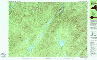
~ Mount Marcy NY topo map, 1:25000 scale, 7.5 X 15 Minute, Historical, 1979, updated 1979
Mount Marcy, New York, USGS topographic map dated 1979.
Includes geographic coordinates (latitude and longitude). This topographic map is suitable for hiking, camping, and exploring, or framing it as a wall map.
Printed on-demand using high resolution imagery, on heavy weight and acid free paper, or alternatively on a variety of synthetic materials.
Topos available on paper, Waterproof, Poly, or Tyvek. Usually shipping rolled, unless combined with other folded maps in one order.
- Product Number: USGS-5455131
- Free digital map download (high-resolution, GeoPDF): Mount Marcy, New York (file size: 26 MB)
- Map Size: please refer to the dimensions of the GeoPDF map above
- Weight (paper map): ca. 55 grams
- Map Type: POD USGS Topographic Map
- Map Series: HTMC
- Map Verison: Historical
- Cell ID: 75242
- Scan ID: 130709
- Imprint Year: 1979
- Woodland Tint: Yes
- Visual Version Number: 1
- Aerial Photo Year: 1976
- Edit Year: 1979
- Field Check Year: 1976
- Datum: NAD27
- Map Projection: Transverse Mercator
- Map published by United States Geological Survey
- Map Language: English
- Scanner Resolution: 600 dpi
- Map Cell Name: Mount Marcy
- Grid size: 7.5 X 15 Minute
- Date on map: 1979
- Map Scale: 1:25000
- Geographical region: New York, United States
Neighboring Maps:
All neighboring USGS topo maps are available for sale online at a variety of scales.
Spatial coverage:
Topo map Mount Marcy, New York, covers the geographical area associated the following places:
- Little Haystack - Fairy Ladder Falls - Haystack Brook - Moose Mountain - Second Pond - Livingston Pond - Elk Lake Marcy Trail - Cold Brook - White Lily Brook - Cedar Brook - Duck Hole - Nippletop - Blake Peak - Lower Asuable Lake - Uphill Falls Brook - Clear Pond Inlet - Niagara Mountain - Boreas Mountain - Rainbow Falls - The Falls - Dix Trail - Crystal Brook - Casey Brook - Stillwater Inlet - Herbert Brook - Hough Peak - Marcy Swamp - Fish Hawk Cliffs - The Narrows - Flowed Lands - The Carry - Nellie Brook - LeClaire Brook - Pinnacle - White Lily Pond - West Inlet - East Inlet - Dix Mountain - Allen Brook - Indian Cove - First Pond - Mount Redfield - Slide Brook - Cascade Brook - Snyder Brook - Lillian Brook - Elk Pass - Panther Gorge - Point Balk - Skylight Brook - Panorama Bluff - Cy Beedes Ledge - Moss Pond - Upper Ausable Lake - Colvin Range - Beaver Point - Lake Colden - Slide Brook - Gray Peak - Teakettle Brook - Mount Marcy - Bartlett Ridge - Macomb Mountain - Rist Mountain - McDonnel Mountain - Shanty Brook - Gravestone Brook - Boreas Ponds - Elk Lake - Deer Pond - Bear Den Mountain - Hunters Pass - Beck-horn - Loon Bay - Mount Haystack - Sunrise Mountain - Cheney Cobble - Mount Skylight - Sand Brook - Four Corners - Little Marcy - Lightning Hill - Jones Beach - Grace Peak - Allen Mountain - Dial Mountain - Dix Pond - Basin Mountain - Beech Ridge - Little Nippletop - Slant Rock - Sawteeth - Lake Tear of the Clouds - Essex County - Dial Pond - Range Trail - Third Pond - Wagon Wheel Landing - Dividing Ridge Trail - Marcy Landing
- Map Area ID: AREA44.12544-74-73.75
- Northwest corner Lat/Long code: USGSNW44.125-74
- Northeast corner Lat/Long code: USGSNE44.125-73.75
- Southwest corner Lat/Long code: USGSSW44-74
- Southeast corner Lat/Long code: USGSSE44-73.75
- Northern map edge Latitude: 44.125
- Southern map edge Latitude: 44
- Western map edge Longitude: -74
- Eastern map edge Longitude: -73.75


