
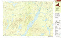
~ Kempshall Mtn NY topo map, 1:25000 scale, 7.5 X 15 Minute, Historical, 1999, updated 2001
Kempshall Mtn, New York, USGS topographic map dated 1999.
Includes geographic coordinates (latitude and longitude). This topographic map is suitable for hiking, camping, and exploring, or framing it as a wall map.
Printed on-demand using high resolution imagery, on heavy weight and acid free paper, or alternatively on a variety of synthetic materials.
Topos available on paper, Waterproof, Poly, or Tyvek. Usually shipping rolled, unless combined with other folded maps in one order.
- Product Number: USGS-5455107
- Free digital map download (high-resolution, GeoPDF): Kempshall Mtn, New York (file size: 16 MB)
- Map Size: please refer to the dimensions of the GeoPDF map above
- Weight (paper map): ca. 55 grams
- Map Type: POD USGS Topographic Map
- Map Series: HTMC
- Map Verison: Historical
- Cell ID: 75393
- Scan ID: 137292
- Imprint Year: 2001
- Woodland Tint: Yes
- Visual Version Number: 1
- Photo Inspection Year: 1999
- Aerial Photo Year: 1976
- Datum: NAD27
- Map Projection: Universal Transverse Mercator
- Map published by United States Geological Survey
- Map Language: English
- Scanner Resolution: 600 dpi
- Map Cell Name: Kempshall Mountain
- Grid size: 7.5 X 15 Minute
- Date on map: 1999
- Map Scale: 1:25000
- Geographical region: New York, United States
Neighboring Maps:
All neighboring USGS topo maps are available for sale online at a variety of scales.
Spatial coverage:
Topo map Kempshall Mtn, New York, covers the geographical area associated the following places:
- Duck Lake - Calkins Brook - McRorie Lake - Upper Moose Pond - Adirondack Mountains - Grampus Lake - Mud Pond Mountain - Mosquito Pond Hill - Round Pond - Buck Mountain Point - Latham Pond - Handsome Pond - Wolf Pond Outlet - Buck Mountain - First Pond - Big Brook Hills - Mosquito Pond - Pine Brook - Boulder Brook - Watch Rock - Moose Creek - Catlin Lake - Beaver Brook - Moose Creek - Blueberry Mountain - Shattuck Clearing - Mohegan Lake - Big Brook - Platt Hill - Comer Pond - Second Pond - Round Island - Slim Point - Big Marsh - Third Pond - Rock Pond Mountain - Kelly Point - Grampus Lake Mountain - Camp Islands - Spruce Top - Corner Pond - Kempshall Mountain - Saint Hubert Pond - Landing Bay - Plumley Point - Pickwacket Pond - Island House - Anthony Ponds - Hedgehog Pond - Mud Pond - Lower Moose Pond - Deer Pond - Landing Hill - Cold River - Pin Cherry Ridge
- Map Area ID: AREA44.12544-74.5-74.25
- Northwest corner Lat/Long code: USGSNW44.125-74.5
- Northeast corner Lat/Long code: USGSNE44.125-74.25
- Southwest corner Lat/Long code: USGSSW44-74.5
- Southeast corner Lat/Long code: USGSSE44-74.25
- Northern map edge Latitude: 44.125
- Southern map edge Latitude: 44
- Western map edge Longitude: -74.5
- Eastern map edge Longitude: -74.25


