
~ Utica NY topo map, 1:250000 scale, 1 X 2 Degree, Historical, 1962
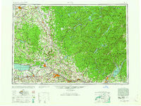
Utica, New York, USGS topographic map dated 1962.
Includes geographic coordinates (latitude and longitude). This topographic map is suitable for hiking, camping, and exploring, or framing it as a wall map.
Printed on-demand using high resolution imagery, on heavy weight and acid free paper, or alternatively on a variety of synthetic materials.
Topos available on paper, Waterproof, Poly, or Tyvek. Usually shipping rolled, unless combined with other folded maps in one order.
- Product Number: USGS-5454907
- Free digital map download (high-resolution, GeoPDF): Utica, New York (file size: 17 MB)
- Map Size: please refer to the dimensions of the GeoPDF map above
- Weight (paper map): ca. 55 grams
- Map Type: POD USGS Topographic Map
- Map Series: HTMC
- Map Verison: Historical
- Cell ID: 69076
- Scan ID: 139458
- Woodland Tint: Yes
- Visual Version Number: 1
- Aerial Photo Year: 1944
- Datum: NAD27
- Map Projection: Transverse Mercator
- Map published by United States Army Corps of Engineers
- Map published by United States Army
- Map Language: English
- Scanner Resolution: 600 dpi
- Map Cell Name: Utica
- Grid size: 1 X 2 Degree
- Date on map: 1962
- Map Scale: 1:250000
- Geographical region: New York, United States
Neighboring Maps:
All neighboring USGS topo maps are available for sale online at a variety of scales.
Spatial coverage:
Topo map Utica, New York, covers the geographical area associated the following places:
- Vail Mills - Edwards Hill - Worth - Sulphur Springs - Seifert Corners - North Western - Mohawk Manor Trailer Park - Fullers - Colemans Mills - Paradise Hill - Mills Corners - Hill Corners - Blossvale - Prussian Settlement - Emmonsburg - Leisher Mill - Sullivan - Hinckley - Whitelaw - Bradtville - Rector - North River - Big Moose - Fayville - Fyler Settlement - Harrisburg - Hasbroucks - Paradise Pines Mobile Home Park - Five Corners - Lorraine - North Amboy - Leisure Village - East Rodman - Progress - Rome - Bleecker - Lynch Tract - North Manlius - North Gage - Steuben - Oneida Valley - Regency Estates Trailer Park - Stillwater - Glendale - Chuckery Corners - Green Acres Mobile Home Park - Canastota - Hooker - Sperryville - High Falls - West Perth - Hope - Woodhull - Pine Hill - Elpis - Honeyville - Greenboro - Soft Maple - Weaver Corner - Brantingham - Winona - Clark Mills - Green Acres - Pumpkin Hollow - Castorland - Kingsboro - South Trenton - Hatchs Corners - Kirkville - Shaw Corners - Starks Landing - Frenchville - Holly Park Mobile Home Park - Walkers Corners - West Day - Perryville - East Martinsburg - Vienna - Oneida Castle - Terrace Hill Mobile Home Estates - Coonrod - Tuxedo Mobile Home Park - Camroden - Irondale - Walesville - Brayton Corners - Fish Creek - Osceola - Sconondoa - Deer Creek Mobile Home Park - Locust Grove - Ephratah - Wheelertown - Clockville - Edgebrook Mobile Home Park - Clinton - Boyd Manor - Keepawa - Blakeslee - Indian River
- Map Area ID: AREA4443-76-74
- Northwest corner Lat/Long code: USGSNW44-76
- Northeast corner Lat/Long code: USGSNE44-74
- Southwest corner Lat/Long code: USGSSW43-76
- Southeast corner Lat/Long code: USGSSE43-74
- Northern map edge Latitude: 44
- Southern map edge Latitude: 43
- Western map edge Longitude: -76
- Eastern map edge Longitude: -74


