
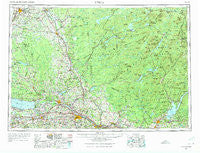
~ Utica NY topo map, 1:250000 scale, 1 X 2 Degree, Historical, 1962, updated 1974
Utica, New York, USGS topographic map dated 1962.
Includes geographic coordinates (latitude and longitude). This topographic map is suitable for hiking, camping, and exploring, or framing it as a wall map.
Printed on-demand using high resolution imagery, on heavy weight and acid free paper, or alternatively on a variety of synthetic materials.
Topos available on paper, Waterproof, Poly, or Tyvek. Usually shipping rolled, unless combined with other folded maps in one order.
- Product Number: USGS-5454905
- Free digital map download (high-resolution, GeoPDF): Utica, New York (file size: 21 MB)
- Map Size: please refer to the dimensions of the GeoPDF map above
- Weight (paper map): ca. 55 grams
- Map Type: POD USGS Topographic Map
- Map Series: HTMC
- Map Verison: Historical
- Cell ID: 69076
- Scan ID: 139457
- Imprint Year: 1974
- Woodland Tint: Yes
- Visual Version Number: 2
- Field Check Year: 1962
- Datum: Unstated
- Map Projection: Transverse Mercator
- Map published by United States Army Corps of Engineers
- Map published by United States Army
- Map Language: English
- Scanner Resolution: 600 dpi
- Map Cell Name: Utica
- Grid size: 1 X 2 Degree
- Date on map: 1962
- Map Scale: 1:250000
- Geographical region: New York, United States
Neighboring Maps:
All neighboring USGS topo maps are available for sale online at a variety of scales.
Spatial coverage:
Topo map Utica, New York, covers the geographical area associated the following places:
- Hale Mills - Castorland - Heyday Mobile Home Park - Colemans Mills - North Chittenango - Camroden - Maple Flats - Clark Corners - Rodman - Turin - Barkersville - Winona - Deerfield Heights - Cranberry Creek - Rockwood - New London - Indian River - Worth Center - Alene - Dix - Woodhull - Middle Sprite - Rome - Galway - Sconondoa - Forest City - West Carthage - McKeever - Durhamville - Valley Mills - North Amboy - Williamstown - Starks Landing - Brewers Corner - Cagwin Corners - Watson - Constableville - Fort Herkimer - Woodland Estates Mobile Home Park - Huntingtonville - Michigan Mills - Pine Meadows Mobile Home Park - Saintsville - Cottons - Stacy Basin - Little America - K And B Mobile Home Park - Hasbroucks - Big Brook - Steuben Valley - Hill Corners - Hagedorns Mills - Mapledale Acres - Newcomb - Rockwell Mobile Home Park - Cleveland - Higgins Bay - Stoneybrook Mobile Terrace - Fox Hill - Kirkville - Barnes Corners - Speculator - New Hartford - Verona Mobile Home Park - Noble Shores - Heritage Acres - Glendale - Old City - Hawkins Corner - Terrace Hill Mobile Home Estates - Otter Creek - Lairdsville - Brookside Manor - Talcottville - Agnes Corners - Soft Maple - Brayton Corners - Rector - Holland Patent - Ruback Camp - Pumpkin Hollow - Bakers Mills - Irish Settlement - Willow Place - Fink Basin - Verona - Swancott Mill - Chadwicks - Shuetown - Christian Hill - Sauquoit - Merrillsville - Manheim Center - Norwich Corners - Bakertown - Gees Corner - Perth - Edinburg - Floral Estates Mobile Home Park - Dumbarton
- Map Area ID: AREA4443-76-74
- Northwest corner Lat/Long code: USGSNW44-76
- Northeast corner Lat/Long code: USGSNE44-74
- Southwest corner Lat/Long code: USGSSW43-76
- Southeast corner Lat/Long code: USGSSE43-74
- Northern map edge Latitude: 44
- Southern map edge Latitude: 43
- Western map edge Longitude: -76
- Eastern map edge Longitude: -74


