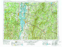
~ Lake Champlain NY topo map, 1:250000 scale, 1 X 2 Degree, Historical, 1962, updated 1975
Lake Champlain, New York, USGS topographic map dated 1962.
Includes geographic coordinates (latitude and longitude). This topographic map is suitable for hiking, camping, and exploring, or framing it as a wall map.
Printed on-demand using high resolution imagery, on heavy weight and acid free paper, or alternatively on a variety of synthetic materials.
Topos available on paper, Waterproof, Poly, or Tyvek. Usually shipping rolled, unless combined with other folded maps in one order.
- Product Number: USGS-5454861
- Free digital map download (high-resolution, GeoPDF): Lake Champlain, New York (file size: 19 MB)
- Map Size: please refer to the dimensions of the GeoPDF map above
- Weight (paper map): ca. 55 grams
- Map Type: POD USGS Topographic Map
- Map Series: HTMC
- Map Verison: Historical
- Cell ID: 68864
- Scan ID: 130041
- Imprint Year: 1975
- Woodland Tint: Yes
- Visual Version Number: 2
- Photo Revision Year: 1972
- Aerial Photo Year: 1962
- Datum: Unstated
- Map Projection: Transverse Mercator
- Map published by United States Geological Survey
- Map Language: English
- Scanner Resolution: 600 dpi
- Map Cell Name: Lake Champlain
- Grid size: 1 X 2 Degree
- Date on map: 1962
- Map Scale: 1:250000
- Geographical region: New York, United States
Neighboring Maps:
All neighboring USGS topo maps are available for sale online at a variety of scales.
Spatial coverage:
Topo map Lake Champlain, New York, covers the geographical area associated the following places:
- North Calais - Palmer Corner - Berkshire - Williston - Pleasant Acres Mobile Home Park - Forestdale - Waterbury - Graniteville - Perry - Peacham - East Berkshire - Bernard J Leddy Park - Morrisville - Tice - Keene Valley - Camp Grounds - Corinth Corners - Peru - Shady Corner Curve - Franklin - Kents Corners - Roxbury - Eden Mills - Jerusalem - North Fairfax - Deerhead - Irona - Georgia Center - High Bank - Grover Hills - Oakledge Park - West Barnet - Stevens Landing - Weybridge - East Barre - Kirby Corner - Plattsburgh - Marshfield - Alburg Center - Beaulieus Corner - West View - Browns Corners - Mill Village - Ferrisburgh - Carter's Mobile Home Park - Cadyville - Jericho - Port Kent - Cedar Beach - Ewells Mills - Westford - Elizabethtown - Hutchins - West Chazy - Moffitsville - Lindsay Beach - Lake Placid - Alburg Springs - East Barnet Inwood Station - Willow Point - Addison - Huntington Center - Mooers - South Walden - Ricker Mills - South Peacham - Bakersfield - Eden - East Highgate - North Hero - Standish - Saint Huberts - Worcester - Coopersville - Robinson - Coles Corner - Ellenburg Center - South Cabot - Cabot - North Williston - West Fletcher - Dannemora Crossing - Lower Websterville - Boquet - East Monkton - Saint Rocks - Enosburg Center - East Alburg - Peasleeville - Tolman Corner - Upper Graniteville - Thayer Beach - Rocky Dale - Bristol - North Elba - Northway Mobile Home Park - Harvey Hollow - Barnumtown - Ecole Champlain - Woodsville
- Map Area ID: AREA4544-74-72
- Northwest corner Lat/Long code: USGSNW45-74
- Northeast corner Lat/Long code: USGSNE45-72
- Southwest corner Lat/Long code: USGSSW44-74
- Southeast corner Lat/Long code: USGSSE44-72
- Northern map edge Latitude: 45
- Southern map edge Latitude: 44
- Western map edge Longitude: -74
- Eastern map edge Longitude: -72

